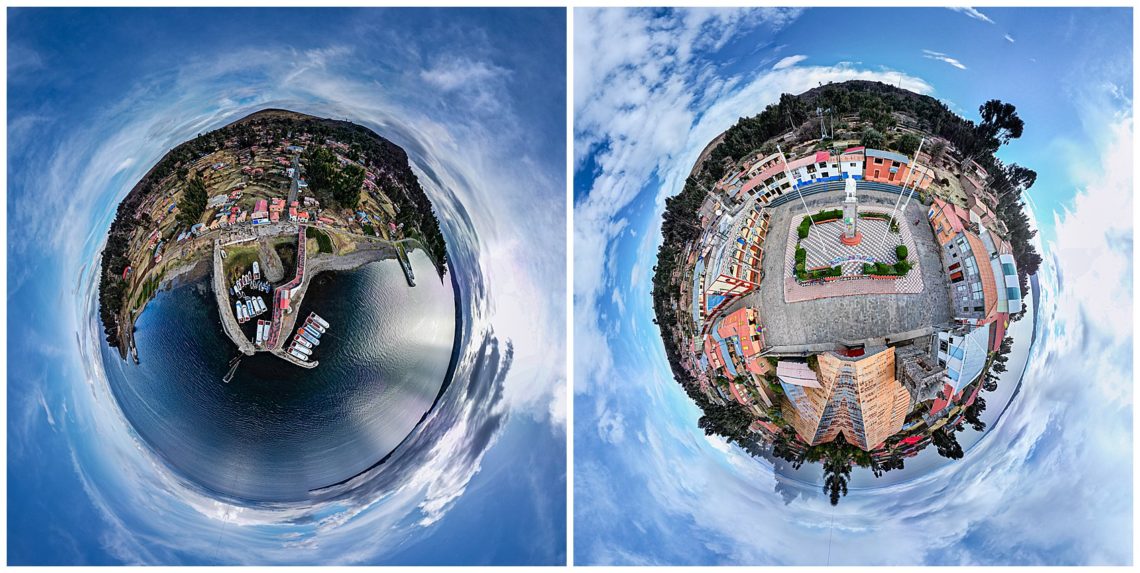
Lake Titicaca is a UNESCO heritage site and is the highest navigable fresh water lake in the world at an elevation (12,507′). It is also the largest lake in South America, bordering Peru and Bolivia. There are an estimated 70 – 114 small floating islands, with the bulk scattered in the shallow depths of the lake near Puno, Peru. The drone images above are from Amantani Island, where we stayed with a local family.

Enroute from Chivay to Puno, the rain storm was off-and-on, which actually enabled us to create an abstract photo through the car windshield (upper-right). The valley that we drove along, is deeper than the Grand Canyon, yet is fully farmed, with steep terraces (middle and upper-right), similar to what we associate with rice terraces in SE Asia. Burt experimented with his first “high altitude” drone flying, and did succeed with creating a few unique images, like the two 360 degree panoramas shown at the top of this post.
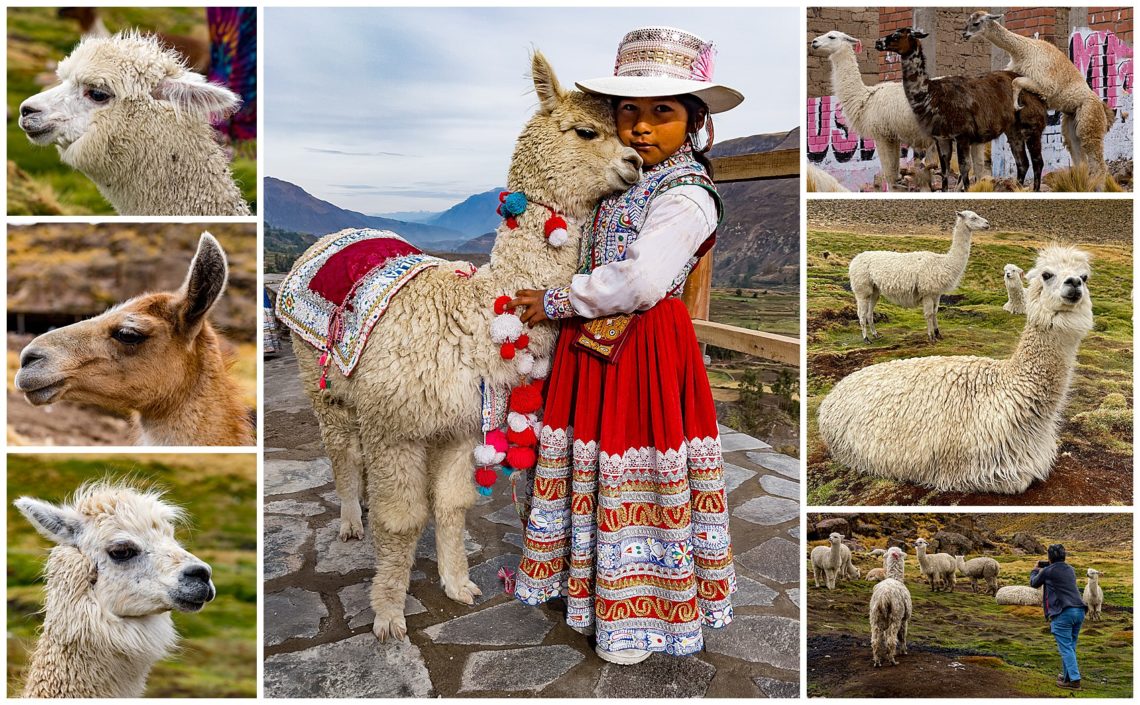
There were many photo stops along the way to capture images of the various animals grazing along the roadside. At one stop, there was a herd of llamas and vicunas grazing within a few feet of the road, so we stopped. The animal herder was a young girl (center) who posed for us. One pair of llamas was busy demonstrating how the size of the herd grows… (upper-right).
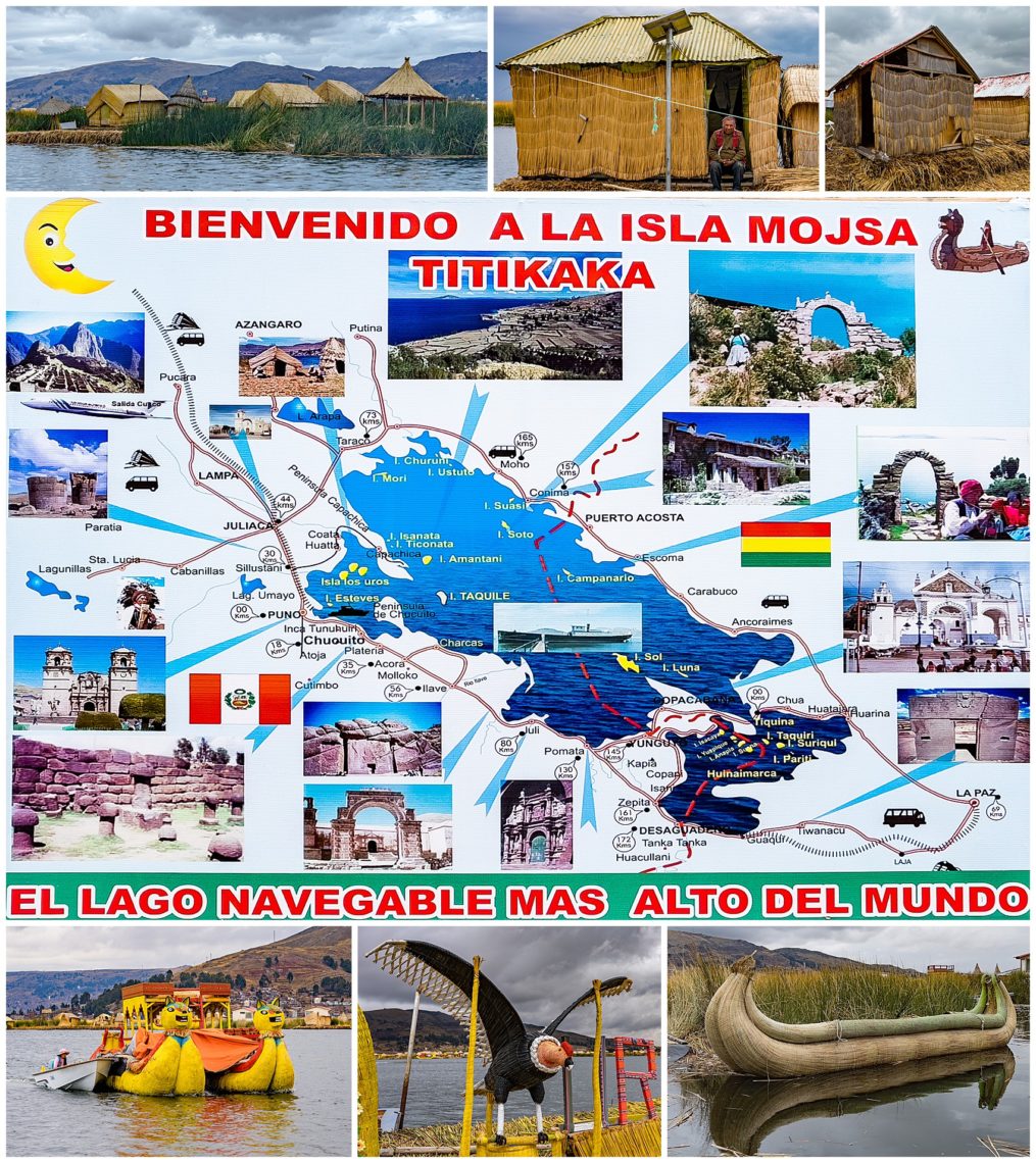
A major destination for this portion of our travels were the floating islands on the lake, populated with the indigenous Uros people, who have lived on the artificial islands for close to 4000 years. These island homes were built when the Inca Empire conquered the Uros, and expelled them from the mainland. The Uros people refused to be subjected. The tribe discovered how to cut the totora reeds naturally growing along the sides of the lake, and to form them into habitable islands. There were originally 70 of these islands, though they have been expanded to approximately 114 since then.
Every 20 or 30 years, the islands deteriorate in the water and must be rebuilt. At that time, an entirely new island is built. Soccer goal posts are put on both ends, and the children are encouraged to play soccer on the island, as a way to beat down the totora reeds into a compact island.
When I asked why the Uros people came here, we were told by the island President (a revolving, unpaid position of the head matriarch of each family) that they were escaping the Incas. When I asked why they stay here now, I was told that they own no land on shore, and would only be a servant class there. Here, on the islands, they pay no taxes and can govern themselves. I asked how they handle criminals. I was told that crime is very rare, and if they do have someone whom is not suitable to live among them, that person is simply evicted from the island.
The Uros people travel back-and-forth from the mainland using boats decorated with condor heads (lower-left). There is also a full-sized condor representation on the dock (center-bottom). The adults realize that there is very little freedom for young people to get to know each other alone, so they have built special “love boats” (bottom-right), which young couples can take and be on the lake alone. The president telling this story giggled, and said “Of course I never used one of those…” ☺
The President (center, plus upper-center and upper-right), showed us how the islands were made, and some of the items they make to sell to tourists. They primarily trade with the mainland for fish they catch, plus handicrafts such as above, to obtain the staples they need, like flour and sugar.
Each island is approximately 50′ X 50′ in size, and is typically occupied by three families. Long straight tree trunks, obtained from the mainland, are driven through the rafts down into the lake bed. As the President said, while describing this to us, “If we did not do that, we would end up in Bolivia, where we have no treaties.”
Evelyn and Burt stood next to simple one room homes on the wobbly island (bottom-left), though opted not to add another stamp to their almost-full passports (bottom-right).
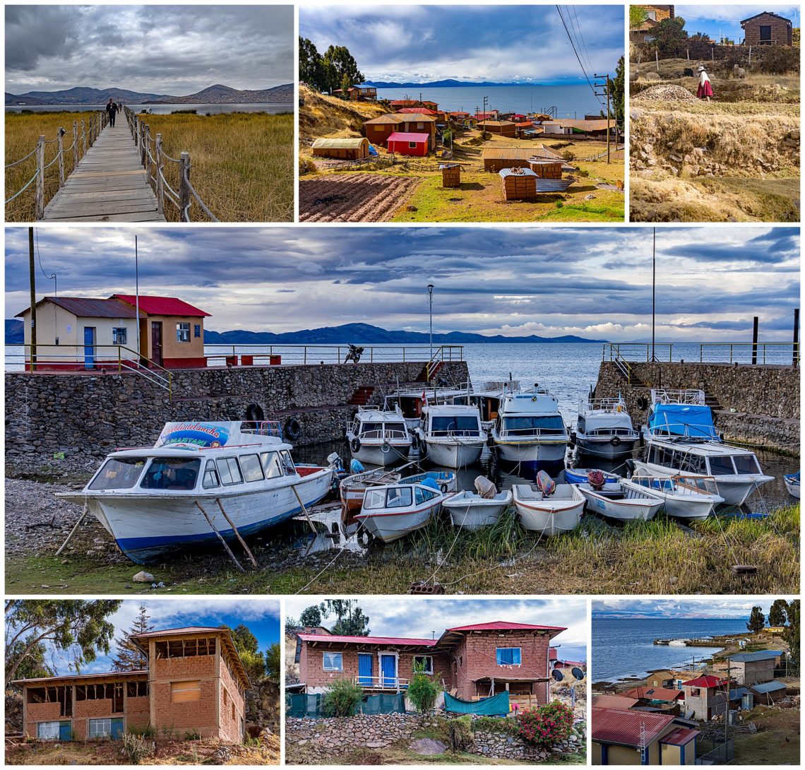
Amantani is the largest of three volcanic islands in the lake and has a population of 3600. It is one of only a few islands where you can live with a local family and see their daily activity. As we walked up from the the dock (upper-left), continuing to go up and up (and up!) for a few hundred meters, we had to stop for breath every couple minutes at this altitude (12,500′).
There was a nice marina at the dock, though most boats were pulled out of the water (center). Other than that, all the homes were built on rocky foundations. We were told that each family had been allocated small plots of land where they grew hardy versions of potatoes, carrots, herbs and other vegetables.
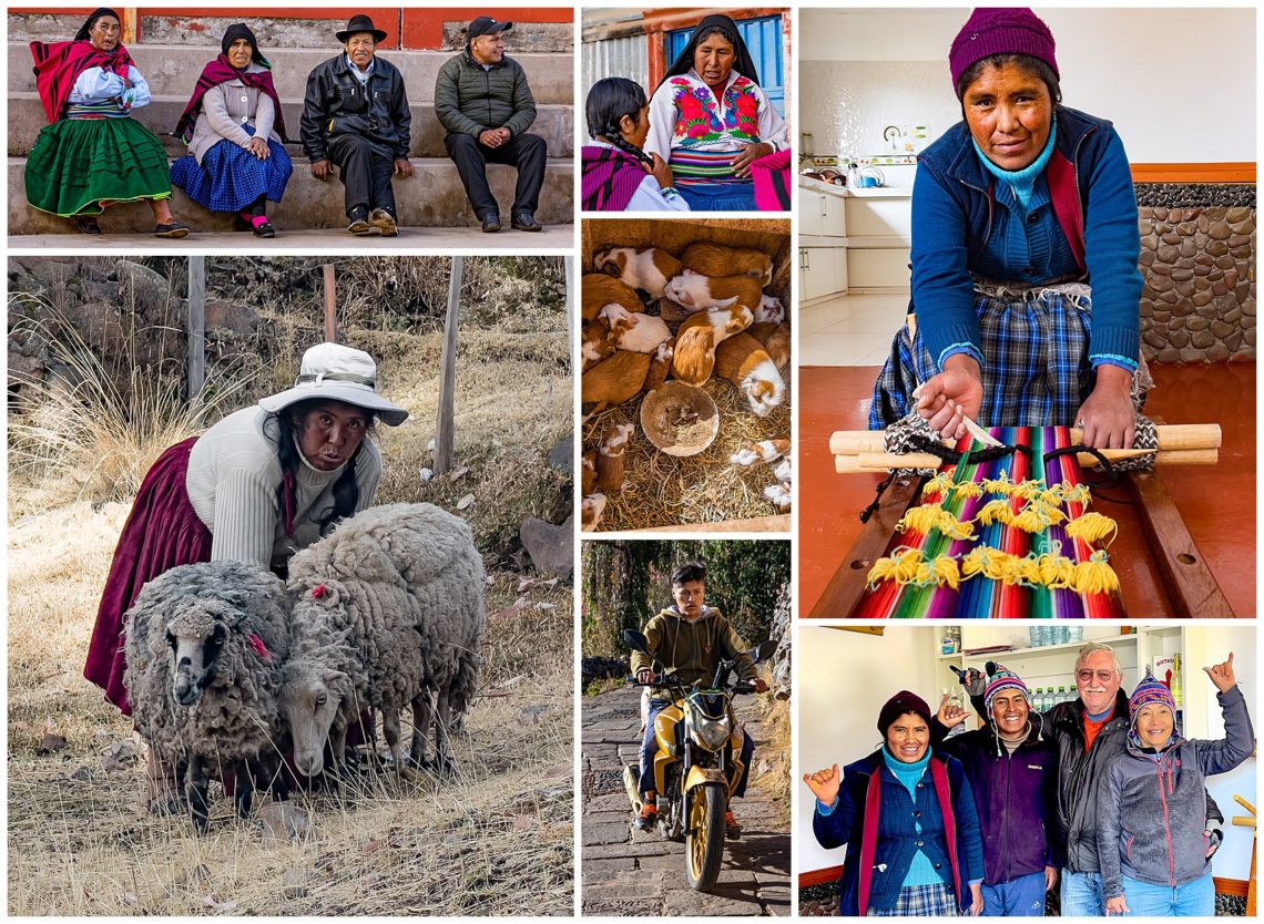
We did a homestay on Amantani island, staying overnight with a local family (lower-right) who cooked our meals and provided a very basic room for us to stay in. The wife wove various textiles and hats (upper-right) to sell to tourists and the mainland. The family we stayed with also raised guinea pigs (center), and many had small herds of sheep (lower-left). The only transportation on the island was motorbikes (center-bottom) or walking. Our host bundled up all of Burt’s luggage and camera (weighing roughly 130 pounds) into a rug, hefted it to his back, and literally ran up the hill all the way to his home (our stay for the night).
His wife gave us a demo on weaving techniques taught by her mother (upper-right), and Evelyn bought a new alpaca hat. Even with 4 layers of heavy blankets, we were still cold. We had hoped for sunnier days to capture the rich deep blue waters of the lake, but it remained cloudy for our short stay.