We are enroute to Gaziantep, the sixth most populous city in Turkey. It is a diverse community populated mostly by ethnic Turks, plus Kurd and Syrian refugees. When we drove through town, we saw substantial damage from the Turkey-Syria 7.8 earthquake, which was followed by a 7.7 after shock, on February 8, 2023. We learned that the safest place to stay during an earthquake is next to a washing machine or refrigerator, rather than under a door way, which might collapse.
The next morning, we stopped to see the beehive domed houses of Harran, a village inhabited since 6,000 BC by the Skellig monks. These homes mimic a beehive architecture, with no windows, and are clustered together like a termite colony. The structure is shaped with a stone cone, to create a roof without timber. I has now become quite commercialized, but you can still the appreciate simple adobe homes. The houses are rectangular on the inside and round on the outside, and carefully built to prevent rain from penetrating the home.
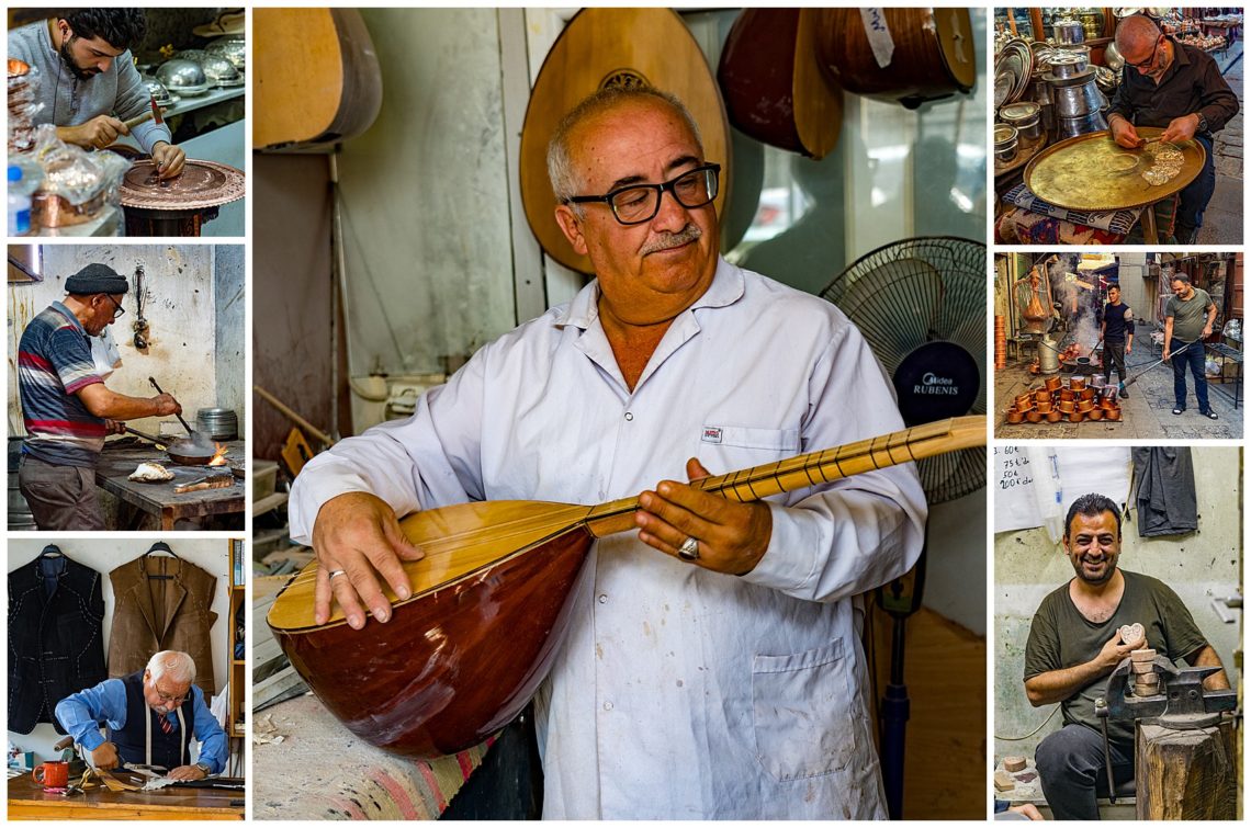
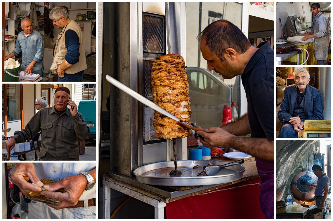
Passing through the city of Gaziantep, we enjoyed seeing traditional musical instrument stores with craftsman who are still making the traditional instruments. One was a kamancheh (center), a bowed instrument like a Persian or iranian violin without a rosette, and played like a violin with 4 strings.
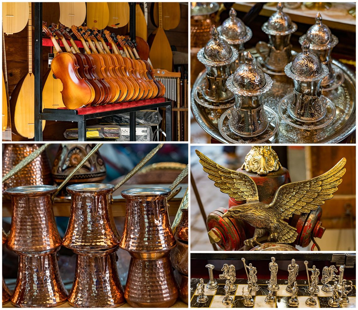
There were many colorful and souvenir shops in the old city of Gaziantep.
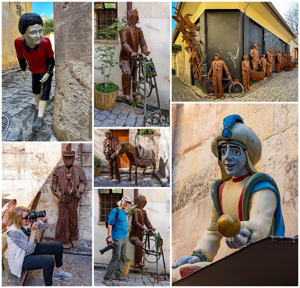
We visited an artistic neighborhood of Gaziantep and photographed the narrow streets with the historical houses, lined with metal sculptures.
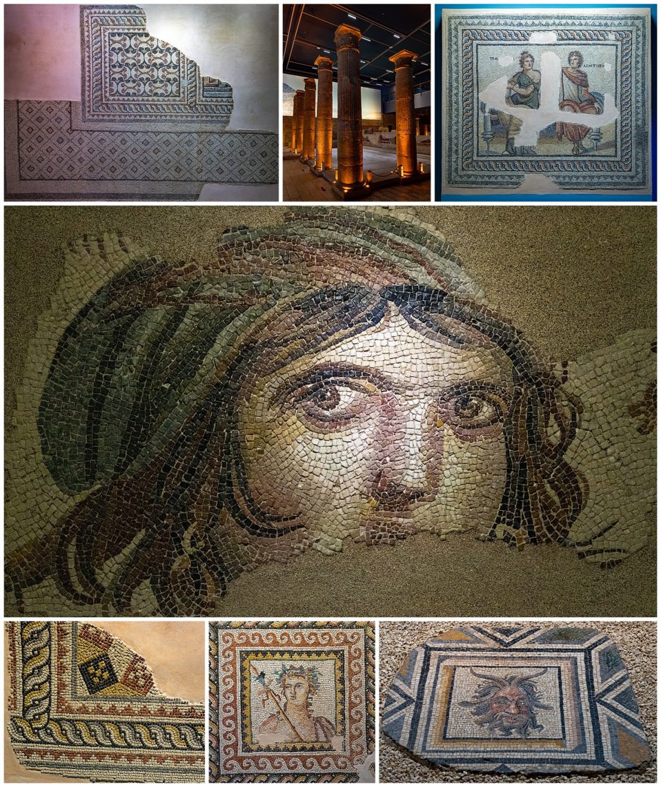
We then toured Zeugma Mosaic Museum, which houses the biggest mosaic museum in the world. This is considered among the top archaelogical treasures in Turkey. Stunning ancient greek and roman mosaics are displayed, mostly intact. This was the first museum we saw that had Selfie stations.
The “Gypsy Girl” is displayed in a special place, like the Mona Lisa (center).
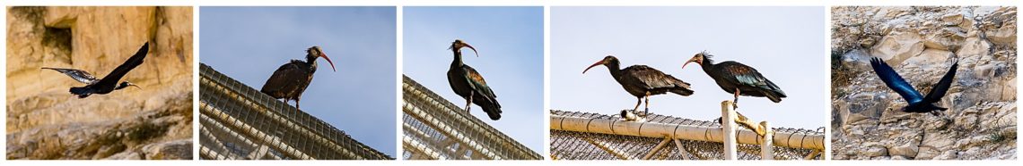
We had a chance to photograph the birds Bald Ibis, in the birds sanctuary of Birecik, which is a reproduction center to increase the Bald Ibis population. The little museum was well done.
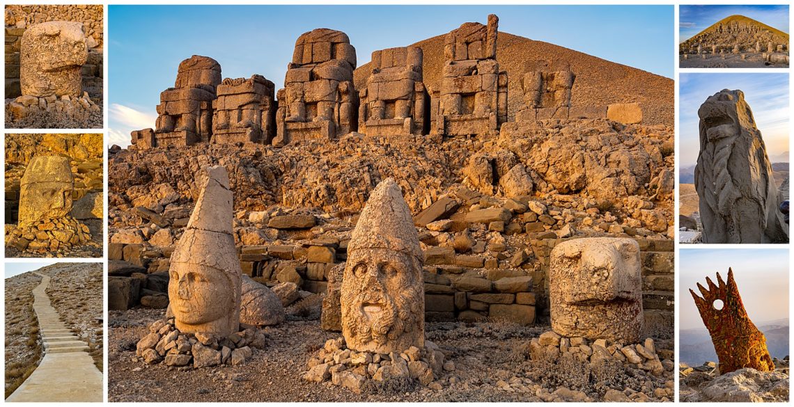
We left our hotel in Aidiyaman by 2:00 AM to climb Mount Nemrut to see the sunrise. Mount Nemrut is 7000 feet high and was designated a World Cultural Heritage site in 1987. The site is covered with statues of the gods, and some consider this site as the 8th Wonder of the World. When the sun rose, the light was breath taking and only lasted for less than an hour.
Crowning one of the highest peaks of the Eastern Taurus mountain range in south-east Turkey, Nemrut Dağ is the Hierotheseion temple-tomb and house of the gods, built by the late Hellenistic King Antiochos I of Commagene (69-34 B.C.). He built this as a monument to himself, placing his statue along with the other gods.
The path up to the top is now paved, with the exception of a very steep part near the top, so we walked up along with hundreds of other tourists. 100,000 people climb Mount Nemrut each year. SE Turkey is one of the best places to learn the history of human civilization, and Mount Nemrut, built in the 1st Century BC, is considered one of the world’s most important historical and cultural heritage sites. It is still a mystery how the carved stones were carried up to the top. Several members in our photo group are shown above sunrise.
After sunrise, the hundreds of tourists leave, and we can enjoy the giant statues photographing the statues of the temple tomb by ourselves. The statues are part of an open air temple with statues on the East and West Terraces located on either side of a tumulus, supposedly the burial mound for King Antiochus. Mount Nemrut is located on the highest peak of the Mesopotamia and is known to contain the tombs of the King Antiochus I of Commagene.
The pattern of damage done to the heads, notably the noses, suggest the destruction was intentional by iconoclasts. However, these are theories only.
The archaeological and UNESCO World Cultural Heritage site on Mount Nemrut, towering at a height of 2,150 meters (about 7,050 feet), survived the earthquakes undamaged. Footage captured by Anadolu showed the massive heads, each of weighs tons, on the eastern face of the mountain in Adiyaman province.
On the way back to Aidiyaman, the administrative capital of this region, we explored Karakus, a funery monument, (a Royal Mausoleum) which is believed to be a burial mound for Queen Isias and Princess Antiochis and Aka 1 of Commagene, wife and sister of King Antiochus. Karakas means black bird, which is the eagle on the column (right bottom). The tumulus is decorated with pillars with eagles, bulls and hand shake scene representing King Antiouchus, and well as the mother of fertility.
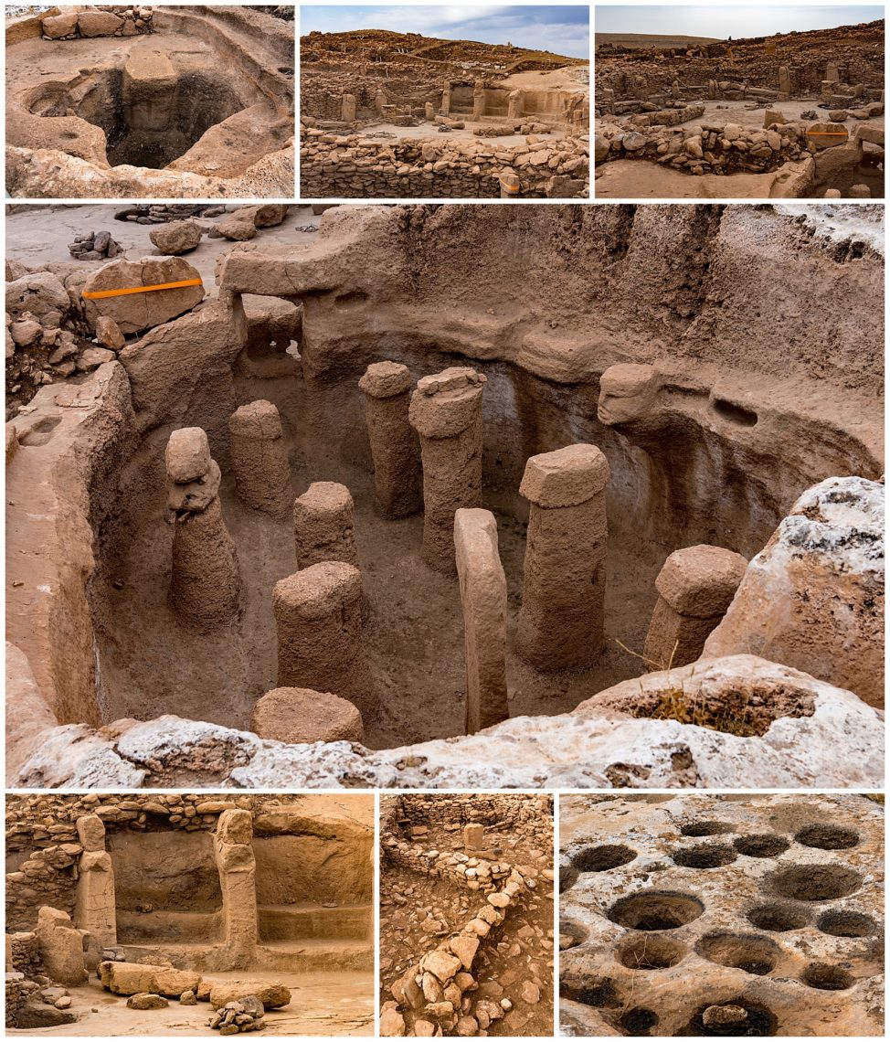
Our next stop was to Gobeklitepe, considered one of the most important archaeological findings of all time, until Karanhantepe was discovered(prior blog). Gobelklitepe is now considered the sister city to the oldest archaeological site in the world, built some 11,000 years ago, both built by the same mysterious civilization. Karanhantepe is older by 1,000 years.
Gobeklitepe has circular temples with T shape pillars decorated with carvings representing foxes, boars, vultures, cranes, snakes, ducks etc build around 10.000 BC. This is the oldest known significant site created by humans. Its purpose is still undetermined, but Stone Age masons created 20 circles of tall rock pillars weighing up to 20 tons.
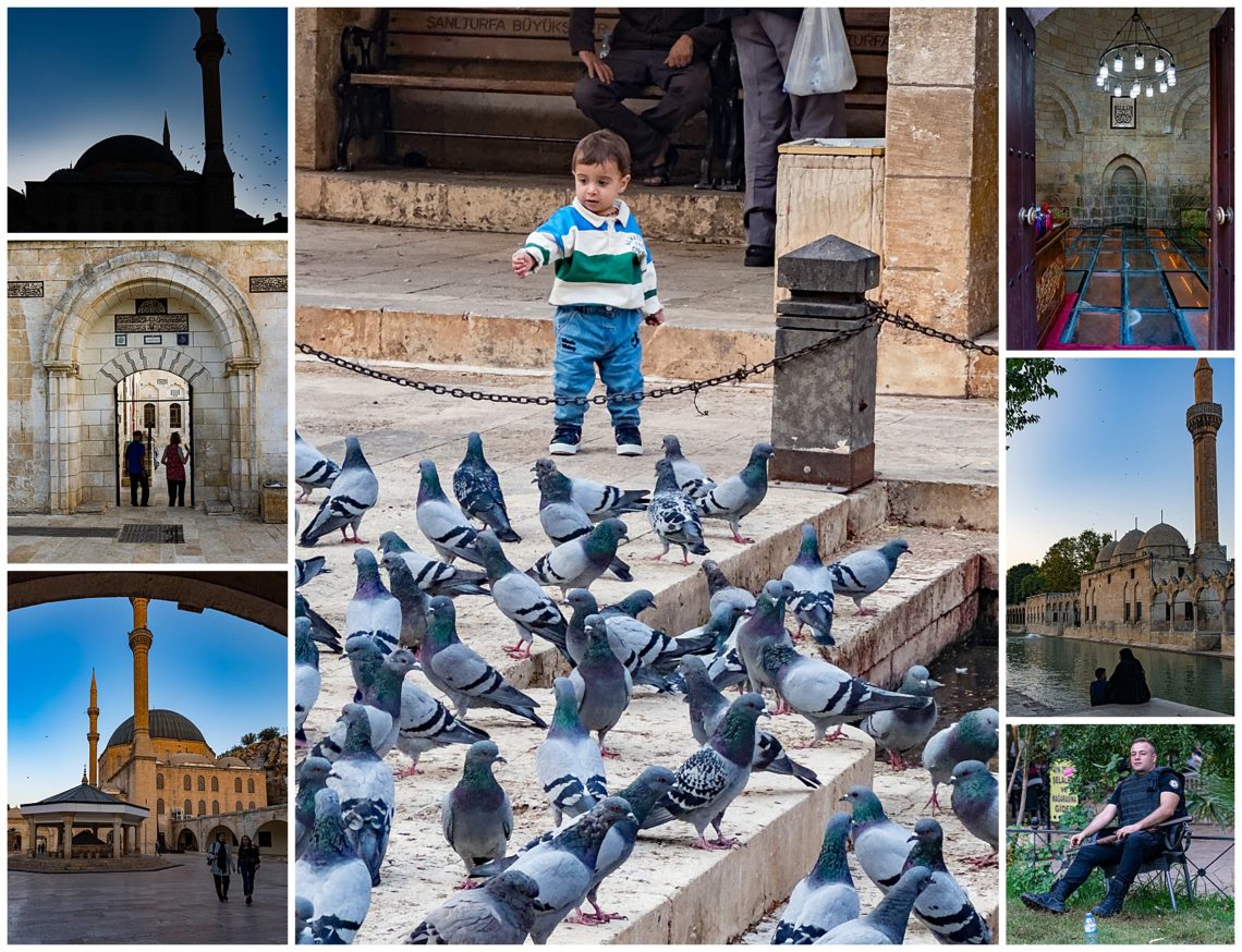
In Sanliurfa we photographed the biblical Abraham’s Pond and also Abraham’s Cave and Mosque in the afternoon.
We visited Karahantepe, an archaeological site in Sanluirfa, where we saw the oldest structures that have been discovered, and were built some 12,000 years ago. This was the first temple built by a mysterious civilization and considered the cradle of our civilization. Some 250 obelisks with animal carvings have been uncovered on this large site. This is very close to another well known archaeological site Göbekli Tepe, which is just 46 kilometers away, and built by the same mysterious civilization. This site is more than 1000 years older than the pyramids that were discovered in Egypt.
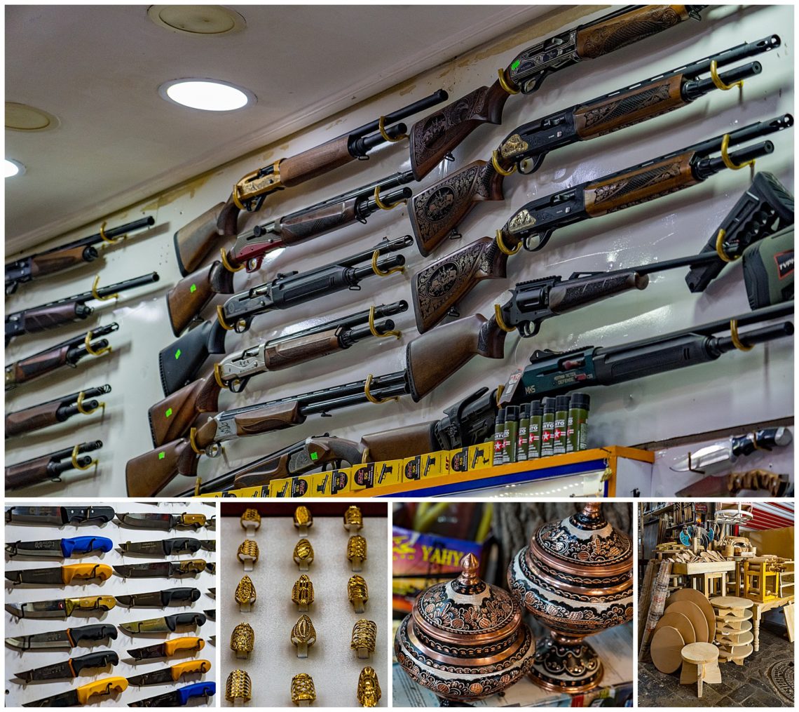
We stopped at Sanliurfa bazaar, which is considered to be one of the most authentic in Turkey (unlike the touristy Istanbul). The bazaar had many twisty alleys with lots of color and even antique guns.
Lots of unique souvenirs… and weapons… for sale in this marketplace. When I took the photo of the guns for sale (top), the vendor came out quickly to tell me “No Photo!” so though they sell these, it is clear they do not really want that fact spread around.
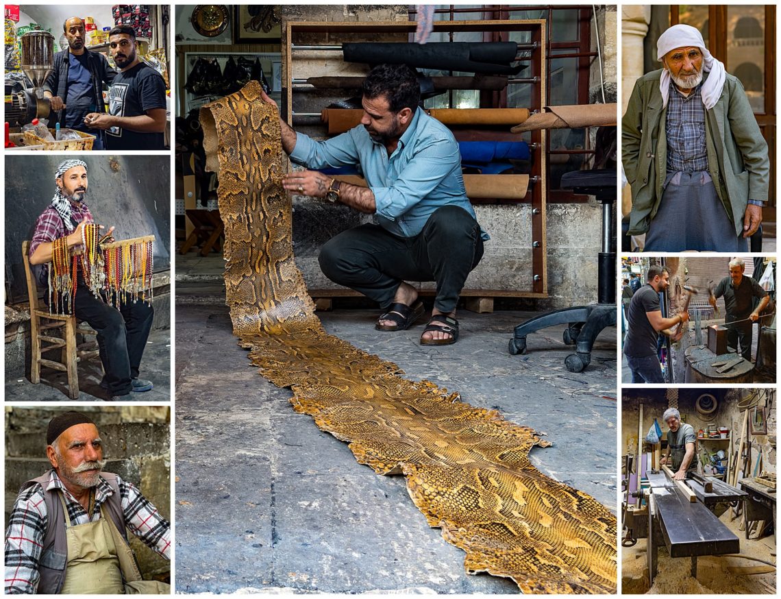
At our Sanliurfa lunch stop in the market, we saw many traditional vendors, including one selling the skin of a large python (center).
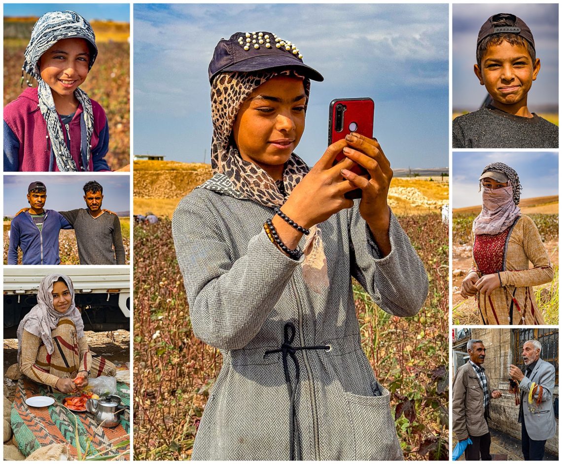
Enroute, we stopped to photograph Syrian refugees picking cotton. Turkish cotton is a premium long-fiber cotton grown exclusively in the Aegean Region, and softens over time. There were many fields ready to be picked, yet we saw very few pickers in the field.
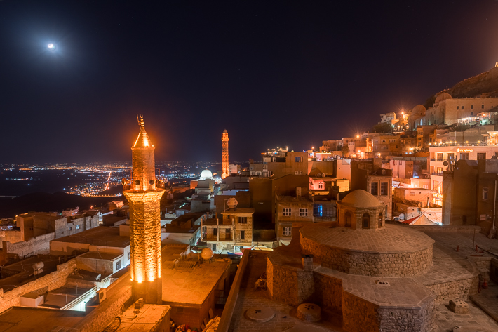
Above is the view of the ancient city of Mardin in South Eastern Turkey, from our hotel balcony. The minaret did not light up until well after the blue hour ended, which is why the sky is black. Mardin is a UNESCO protected city and one of the most significant cities located in SE Turkey. It is strategically located on a rocky hill near the Tigris River. Mardin is historically Syriac and Assyrian, though now part of Turkey.
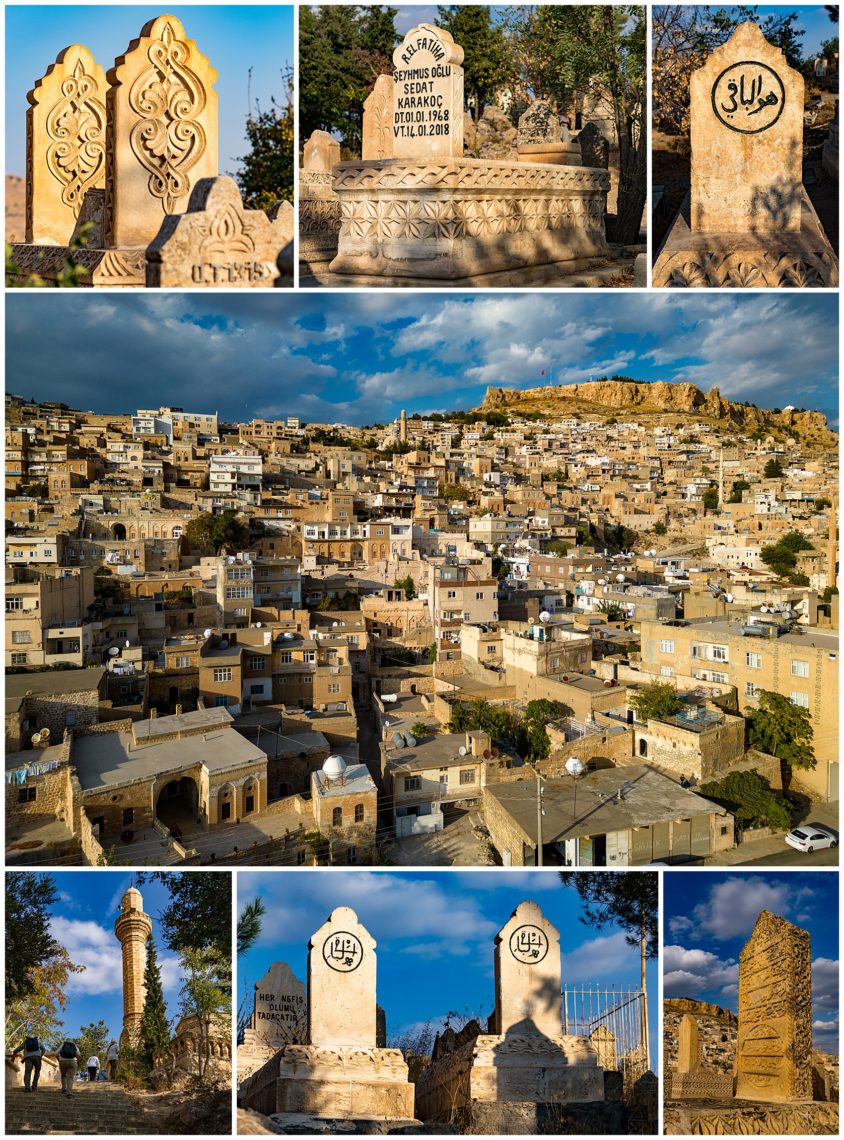
This cemetery has one of the best views of the Old Quarters in Mardin. We were warned not to fly the drone to take photos over the cemetery, since it is 20 miles to the Syrian border. We did get the one image of the neighboring city (center) before being told we had to stop our flight though.
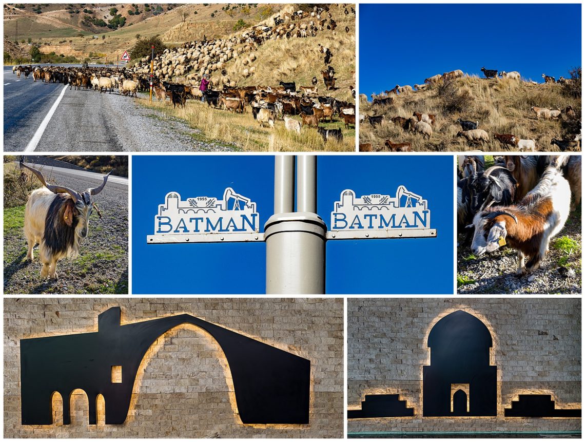
As we were driving between cities, we passed a rather large herd of sheep and goats, which we stopped to photograph (top row, plus middle-left and middle-right). Batman provided a unique lunch stop. We loved the name of the city, and the town street signs were interesting (middle, plus bottom row). It seemed rather surprising that the town has not leveraged their name with the comic and movie hero, but there was no indication of such a tie-in.
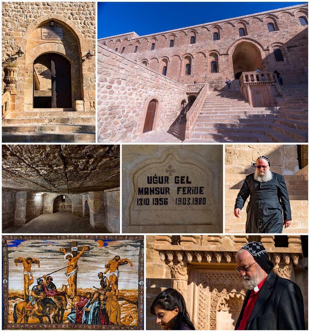
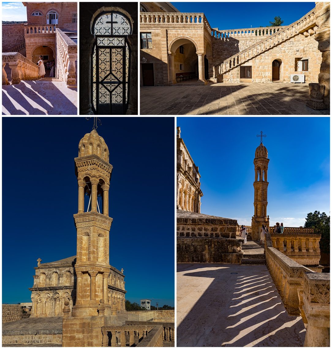
We also photographed the Deyrulzaferen Monastery which is an important Syriac Orthodox Monastery built in the 4th Century BC.
We really enjoyed seeing the shadows cast onto the ground around the monastery. The late afternoon light was a photographer’s delight.
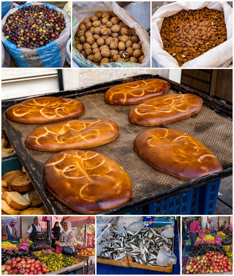
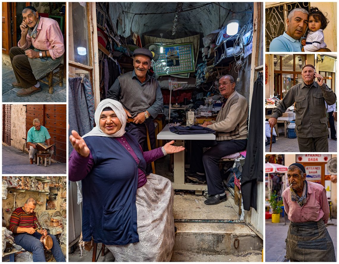
We next walked through the bazaar area of Mardin, photographing local craftsmen and spent time taking photos of a man in green shirt reading Koran while on break from his copper making (middle-left). There were lots of fresh fruits and vegetables. It was pretty obvious that there are very few young people left in town. It seems they have largely moved to urban areas to find better paying work.
Some vendors sold prayer beads, which are used to count (middle left). The number of beads on the chain depended on the religion. Throughout the area, people smiled and were willing to be photographed whenever they saw our cameras.
Many vendors were preparing food their customers (middle), while many others were making products (lower-right), or selling from their small stalls.
We have always enjoyed authenticity and this place met the criteria for an interesting and exotic travel experience.
We continue our journey exploring Eastern Turkey enroute to Van, which is filled with ancient sites and many views of Mount Arawat. We took a ferry ride out to Akdamar Island, to photograph an Armenian church. This was a perfect chance to send up our drone, to get aerial images of the church (upper-left, upper-center and lower-right).
Fortunately, we had clear skies and Mount Aarat (where Noah is believed to have landed) was not covered by its usual shroud of clouds.
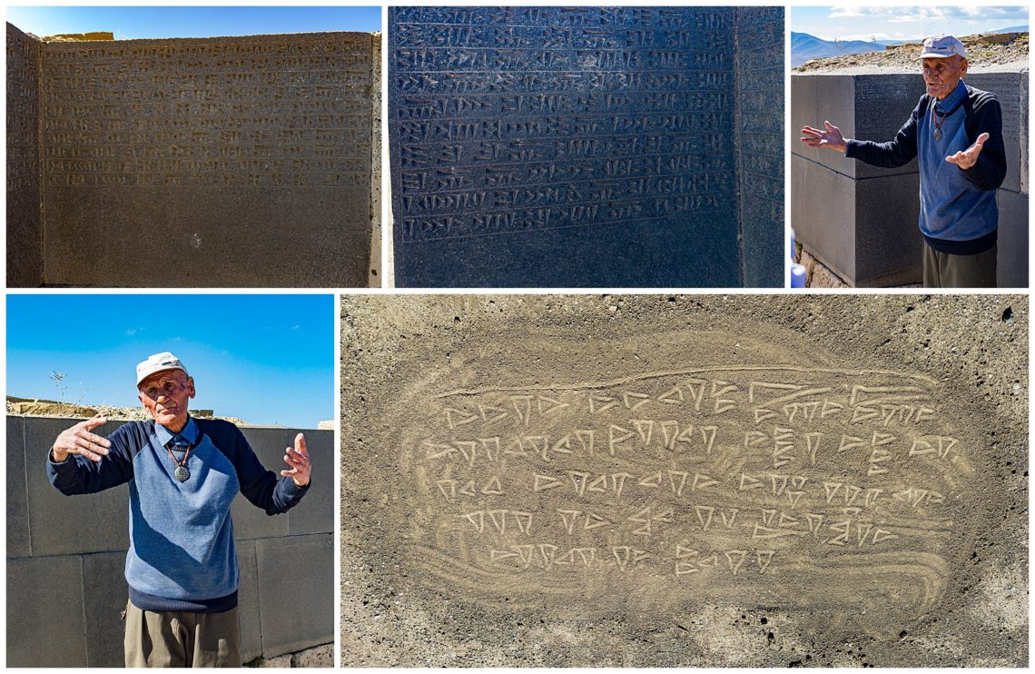
We climbed to the ancient site of Cavustepe which was a fort built by the Urartians in the 7th Century BC. The caretaker we met is one of the few in the world who can read and wrote the cuneiform script, He described it in detail, though we did not transcribe, nor remember, his explanation. He later wrote a message to us in that lost language in the sand (lower-right).
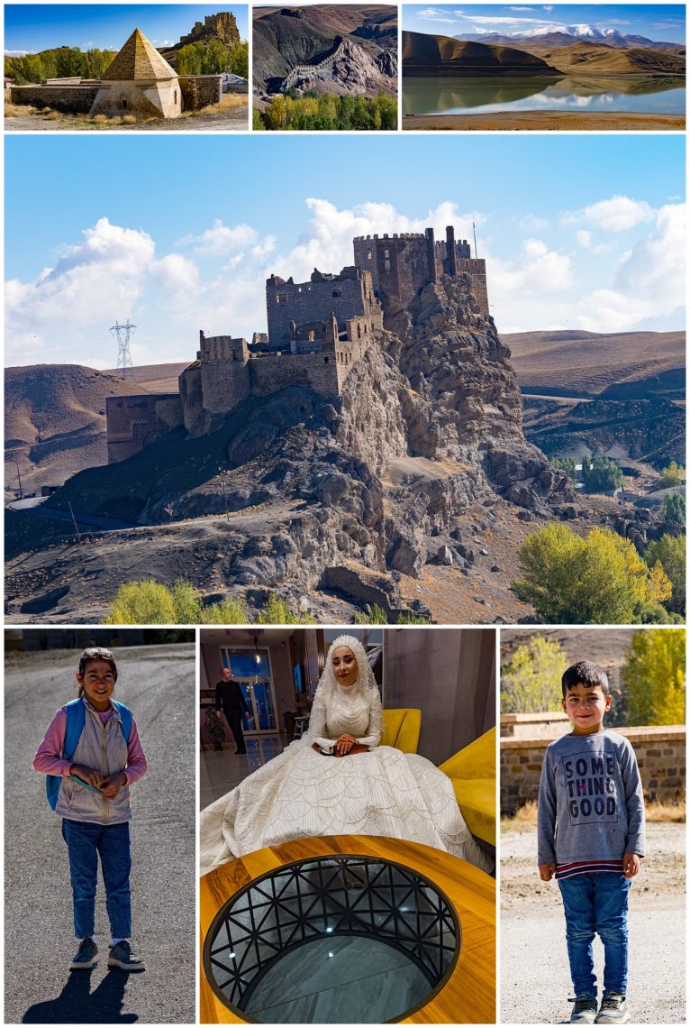
We were able to view the 18th century Hosab Castle from both higher angle (via drone, center) and lower angle (via handheld camera). Enroute, we stopped to photograph reflections of the mountains in the lake (upper-right). When we returned to the hotel this evening, we were greeted by a bride in the lobby, who was waiting for her husband to check in (middle-bottom). Many wedding couples stay here to be photographed in front of landmarks.
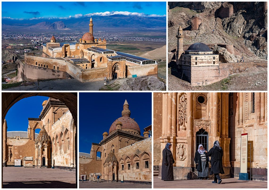
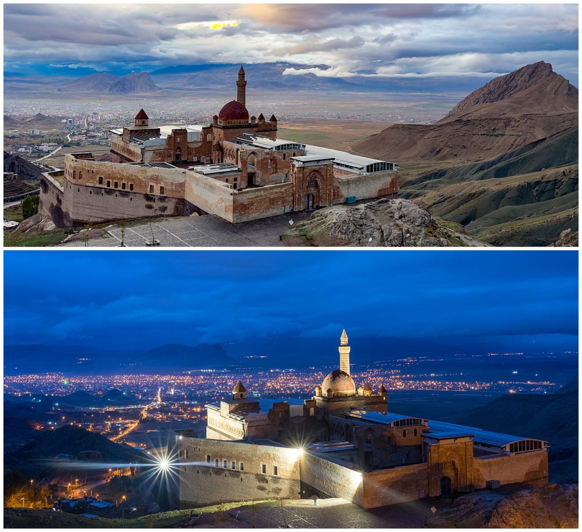
As we traveled along the Iranian border, we were warned not to fly the drone. We were still able to capture stunning views of Ishak Pasha Palace in the morning from a cliff above (upper-left), then had a chance to check out the insides. We were able to see the beautiful shadows cast inside as well as much detailed carvings. This palace was built during the Ottoman period, and is one of the few surviving historical palaces from that period.
At sunset, we found an opening in the fence into the pasture and photographed the 8th Century BC Van Fortrress with herd of sheep in the foreground.
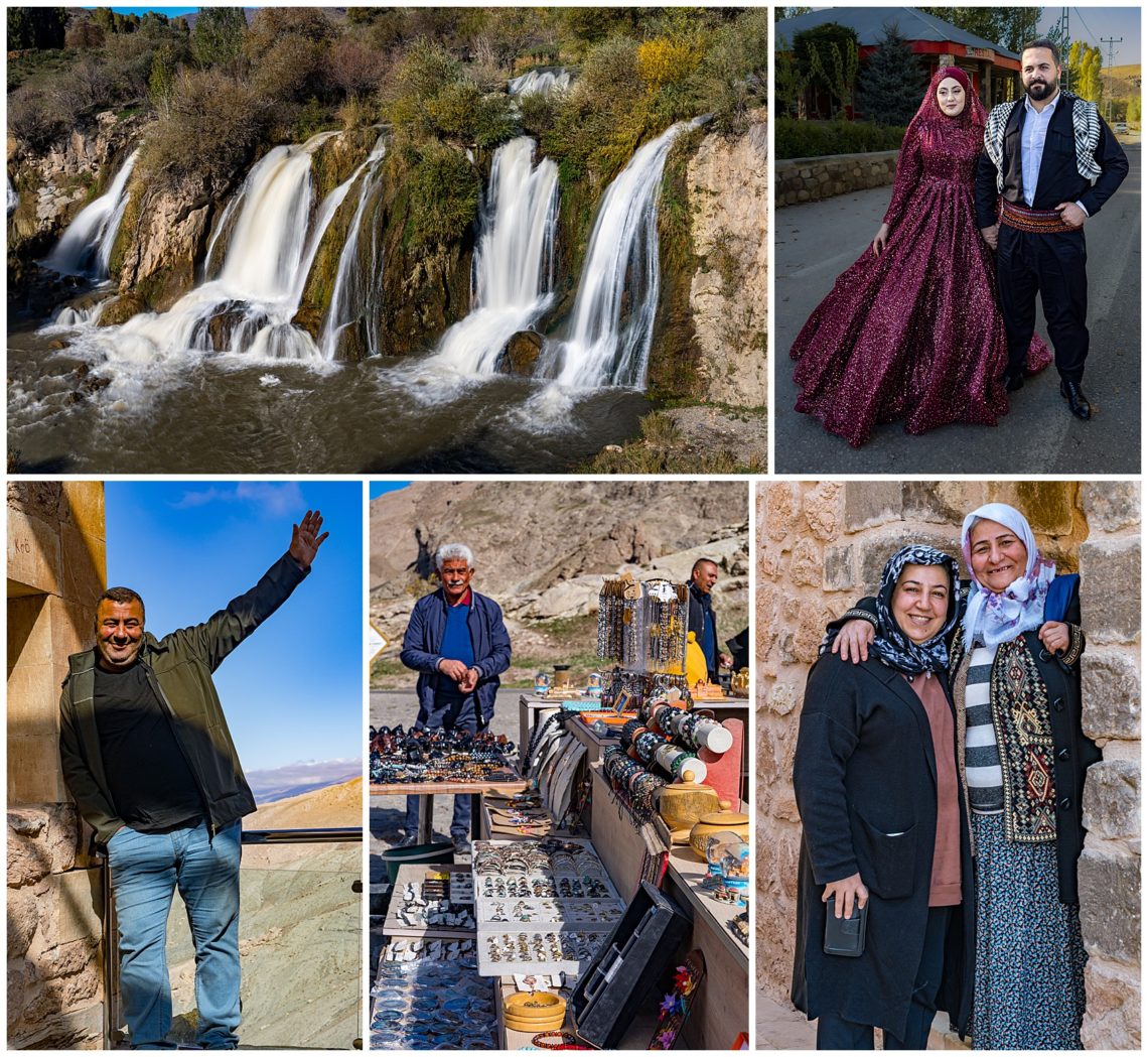
Enroute to view the 50 meter high Muradiye Waterfalls, which is where locals come and picnic located 80 km from Van. We enjoy seeing the rural countryside of Eastern Turkey, where many people are still dressed in traditional clothing.
Here are more views of Mount Ararat and an archaeological site believed to be the final location of Noah’s Ark (middle-top). The dimensions cast on the ground are approximately the same as the size of the ark mentioned in the bible, and dating soil samples reveal human activity match the timing, however it is still quite controversial whether this was the correct location
Herding cats is a colloquial term, and that was what we found in a local university research center. We had an opportunity to photographed the Van cats, known for having two different color eyes, one blue and one green. One cat was captivated by Mehmet, as it jumped on his back (center).
We photographed the ruins of the old Armenian capital of Ani located right on the border between Turkey and Armenia. Ani is an old fort situated at the top of a massive hill, and is currently being restored. We met shepherds with their cattle still working the hills.
There are impressive ruins of Armenian churches and settlements on this large site. We stopped to photograph the 13th century, arched bridge known as “Cobandede Koprusu” with its reflections in the Aras River.
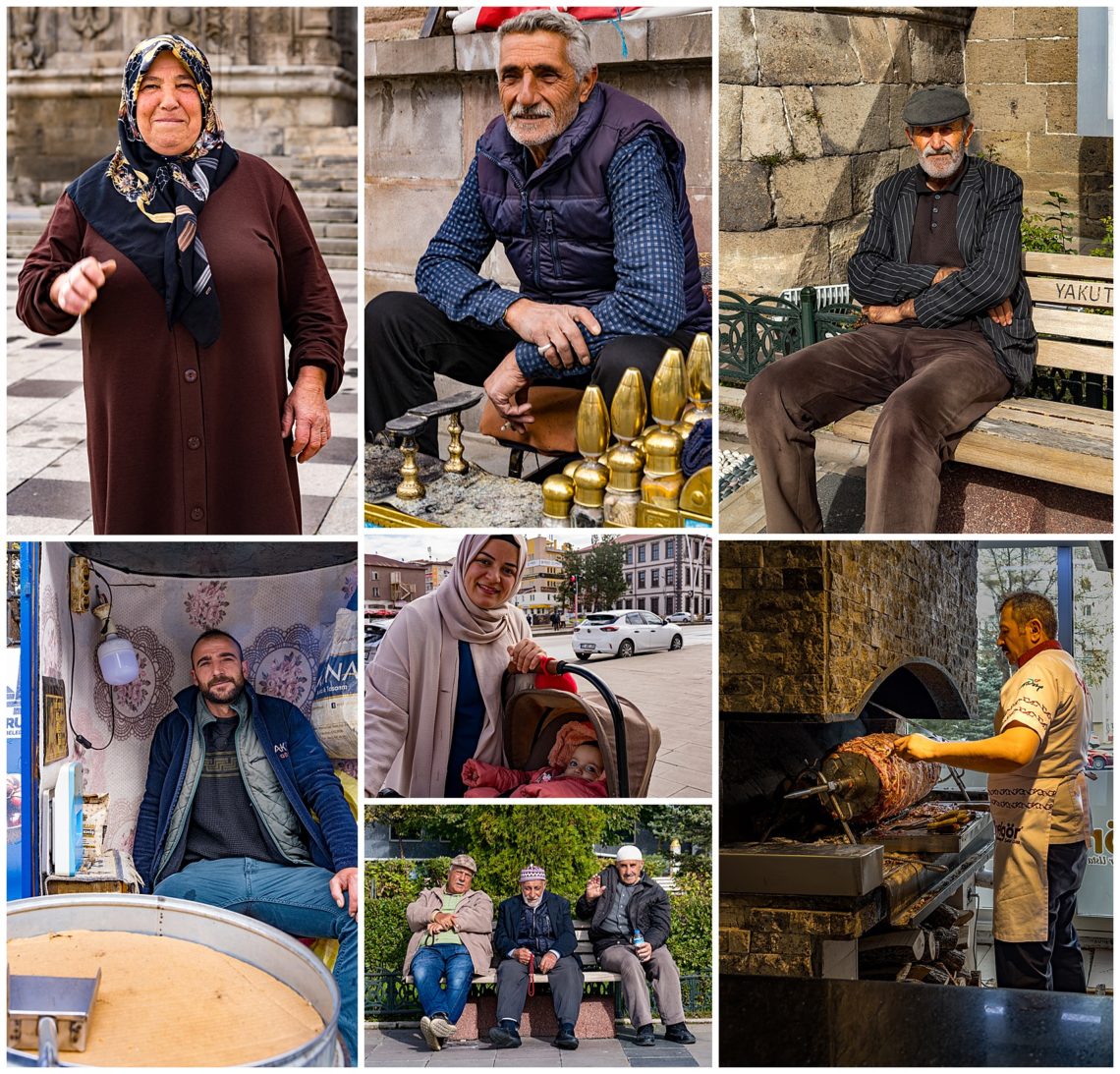
Lots of photos of daily life with its colorful characters. We found that people are quite friendly and enjoyed having their pictures taken.
Enroute, we were capturing images of a vendor selling giant cabbages (upper-right). Cabbage heads at the vendors stalls in town were humungous, and we’re wondering about how to eat the large salads for breakfast, lunch and dinner.
View from our hotel in Kars at the Blue Hour. The Blue Hour is significant for photographers, as it is the hour after sunset when the sky turns the most blue.
We stopped to photograph the Tuzluca Salt Mine in Dogubeyazıt. The Tuzluca Salt Mines are still active and located on the road between Iğdır and Kars and can be seen here on our East Turkey Road.
We have just started the “off the beaten track photo tour of Eastern Turkey” with Mehmet Ozbalci of Turfantastik. This will be our sixth trip with Mehmet since discovering him nearly a decade ago on our first tour of Western Turkey (click here to see the list of 26 blog posts from that trip).
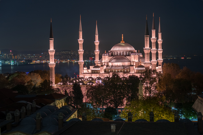
The photo above is a view from our hotel, Arcadia Blue Hotel, in Istanbul. To our surprise, the Blue Mosque is now bathed in warm pink lighting instead of the previous blue after the recent remodel.
We typically arrive a couple days early for these trips. That allows us to acclimate to the timezone change, and allow for any flight problems to be resolved. Well… this time we really needed that buffer. When we arrived in Istanbul, we discovered that our luggage was still in London (our 2nd stop on the 3-hop flight between Honolulu and Istanbul). We have AirTags in all our luggage and could tell both our bags were still in the Turkish Airlines storage area at Heathrow Airport. After 11 calls from me, and several more by Mehmet, our luggage finally arrived 4 days later… in Trabzon, another airport as we had already left Istanbul. We were rather anxious about getting those suitcase, as they had our cold-weather clothes, needed a few days later.
Other than the wasted time on phone calls, and the small amount of money spent on temporary clothing needs, this was just a minor hiccup in a trip that otherwise went smoothly. After having traveled to 98 countries (this is our third time in Turkey), these small bumps in the road are just just something we can shrug off and use to tell stories at parties… ☺
We spent the first couple days in Istanbul just wandering the streets in the Galata Tower area. We lived in Istanbul for 3 months in 2016 on a home-exchange, so we were already familiar with most of the landmarks. We were surprised at the long Disneyland-like lines to get into the Haghia Sofia and the Blue Mosque this time though. We were able to just breeze through in 2016. The tourists are back… (Of course, we do not consider ourselves tourists… We Are Travelers!☺)
Our tour will explore various UNESCO designated world heritage sites in Eastern Turkey, where our civilization began. One of our first stops was to photograph the 14th century Greek Orthodox monastery of Holy Mary known as Sumela located on the side of a cliff enroute to Uzungöl, a small mountain village in the Caucasus. Our trip takes us across many tea plantations, where we occasionally stopped to watch the lucious tea plateaus.
Reflections from Uzungöl Mosque onto Lake Uzungöl (upper left). We then walked around the village of Karaster, which is a village where the nomadic tribes roam and a second home to some Turkish families. Enroute, we’re enjoying the beautiful fall colors.
We returned to shoot the quaint Uzungöl mosque at the magic blue hour, with its two minarets cast onto the still lake below. Mehmet captures the interior of the mosque (upper-right) as well as more scenes enroute (middle-right).
In Erzurum, we explored many ways to capture the reflection of the Yakutiye Madrasa on the glass tile (lower-right). This was originally a 13th century theological school, and is now a museum. We next photographed the 12th century Ulu Mosque, one of the oldest mosques in Turkey. Regular characters enjoy just sitting in the park to socialize (upper-right).
Before lunch, we shot the “Oltu” bazaar in Erzurum, which is known for its “Oltu” stone, a semi precious stone (fossilized carbon) known as black amber.
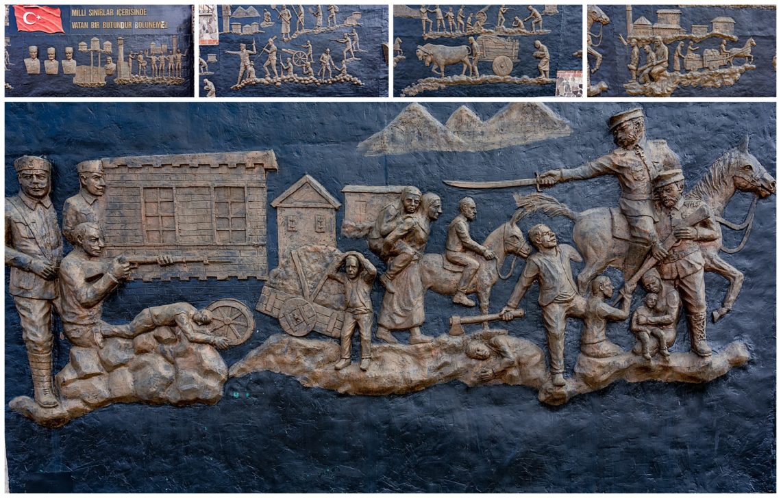
On our walk to lunch to taste the best kebabs in Turkey, at a restaurants known as “Cağ Kebab”. we passed by a 3-D mural depicting scenes from World War 1. All but 200 Armenians were executed in WW1.
More scenes from medieval Erzurum, with its rich history. Here’s a link providing more details of the town and history of its people.
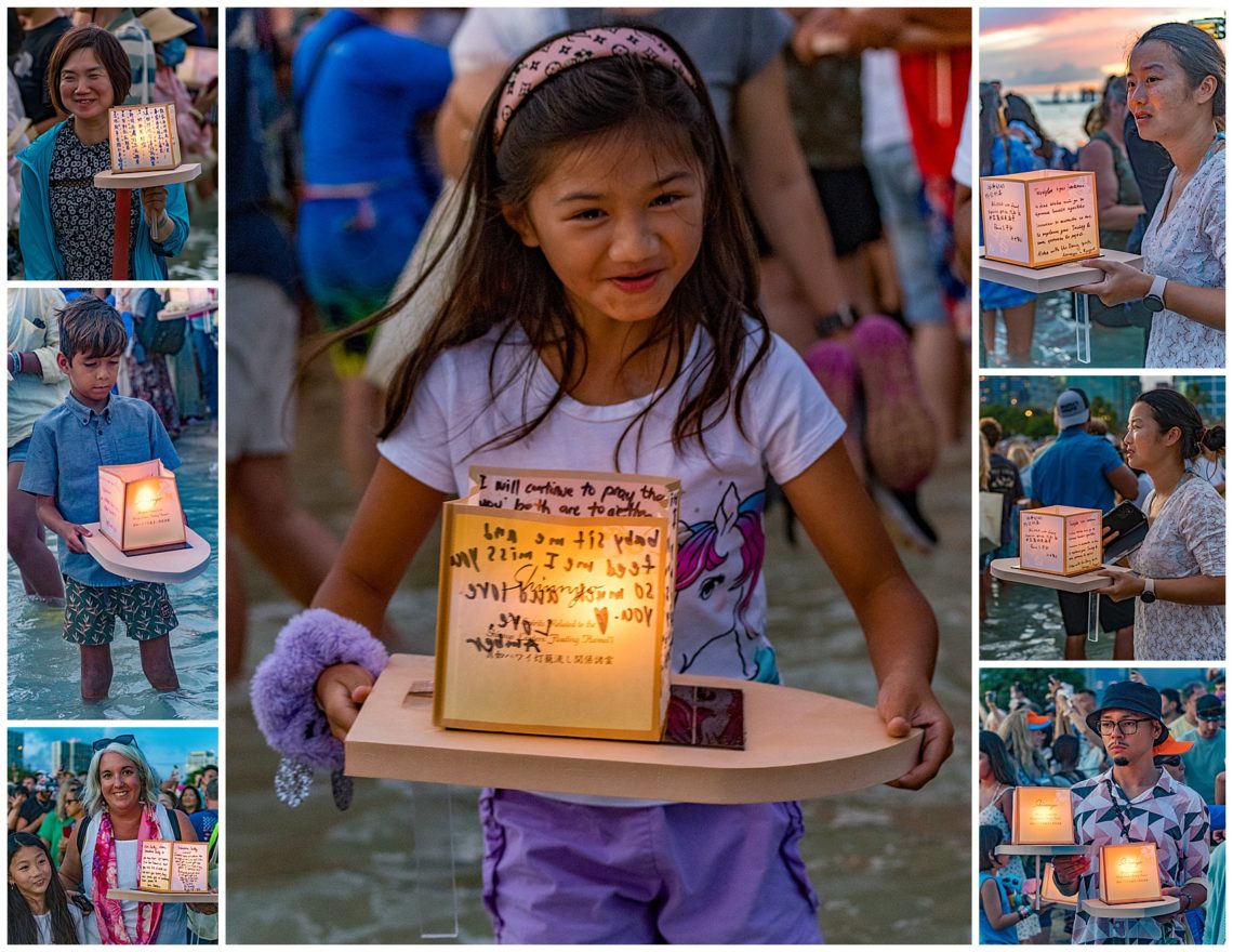
After 3 years of absence due to Covid restrictions, the annual Shinnyo Lantern Floating festival returned to Oahu, Hawaii this Memorial Day again. Shinnyo-en is an international Buddhist community and teaches “reality, or the true nature of all things”. The red lanterns provide light and guide the souls of the deceased toward peace. The light also symbolizes sending away the darkness, and welcoming a bright, peaceful future for the upcoming year.
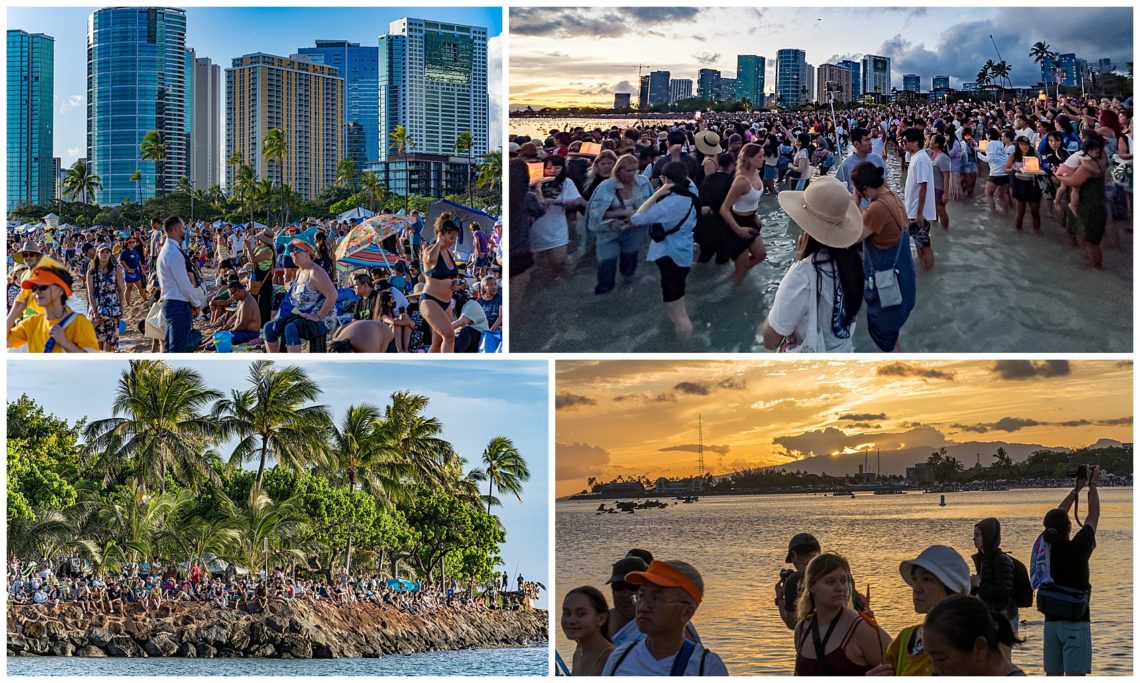
This was my first time seeing this festival, and it was well worth working through the crowds for. The festival was held on Ala Moana Beach, which is only a little over a mile from our home. Evelyn could not attend, because she had foot surgery just a week before and the crowded sand is not conducive to crutches. Since I took my moped, I could wind through the cars and park very close to the launch point.
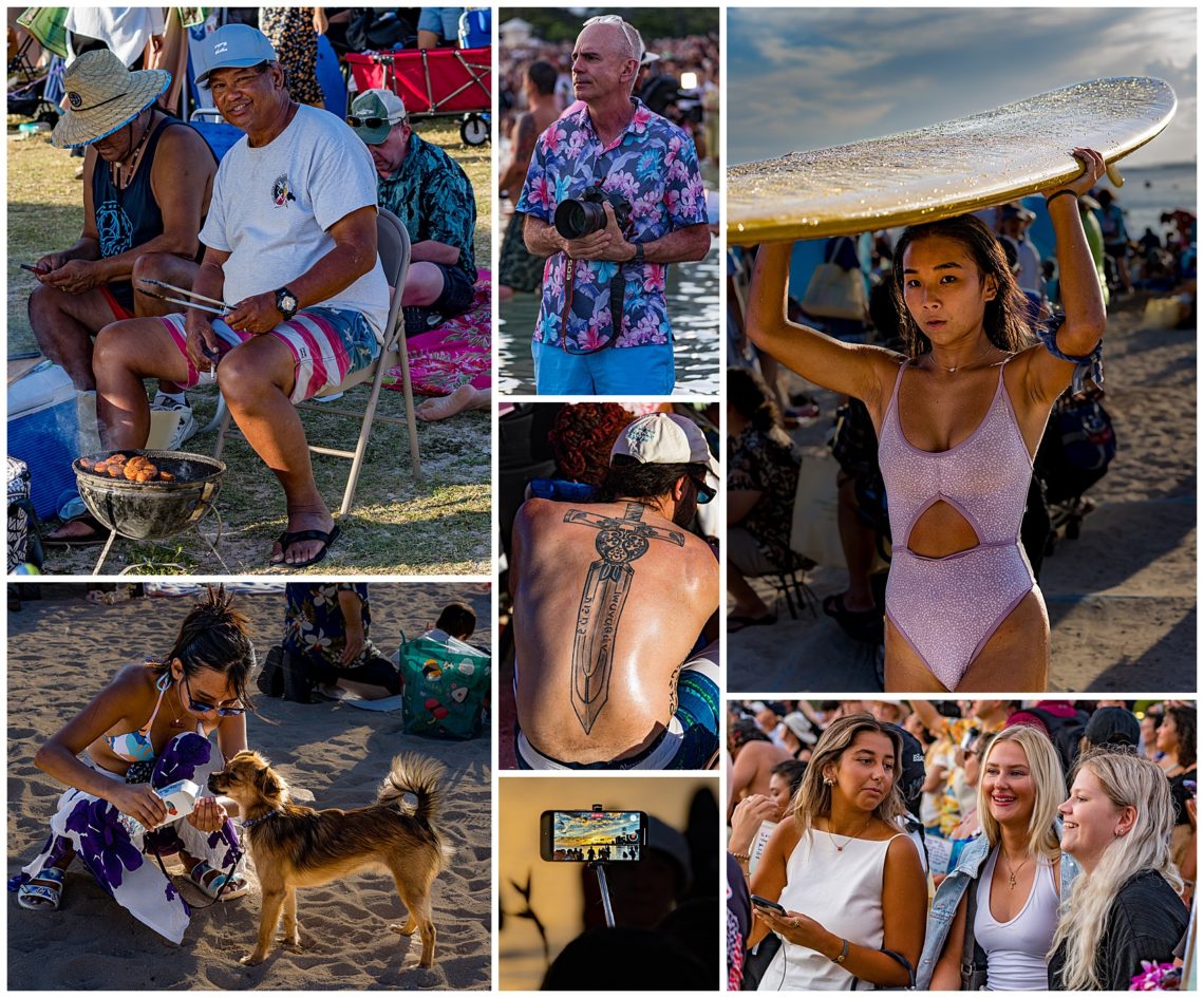
Arriving early, there was plenty of time to people-watch.
A series of huge video screens were scattered across the beach, allowing everyone to see the official speeches and performances. The festival opened with a speech in Hawaiian by Her Holiness Shinso Ito (top left), with English translations shown on the screen.
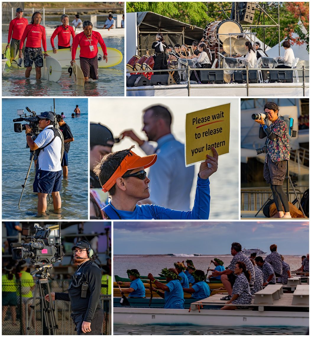
As the festival began, approximately a dozen men from fire, police and military were introduced, who then entered the water with surfboards to act as water-based security (upper left). Drummers then played Shinnyo Taiko to call people together (upper right, plus video at the end below). Official photographers and videographers were the only ones allowed on boats, or who were brave enough to take tripods into the ocean. I walked into the water knee high as the beach was packed.
The beach filled up with an estimated 50,000 people by the time the official festivities began. You can see the crowds at Magic Island (bottom left).
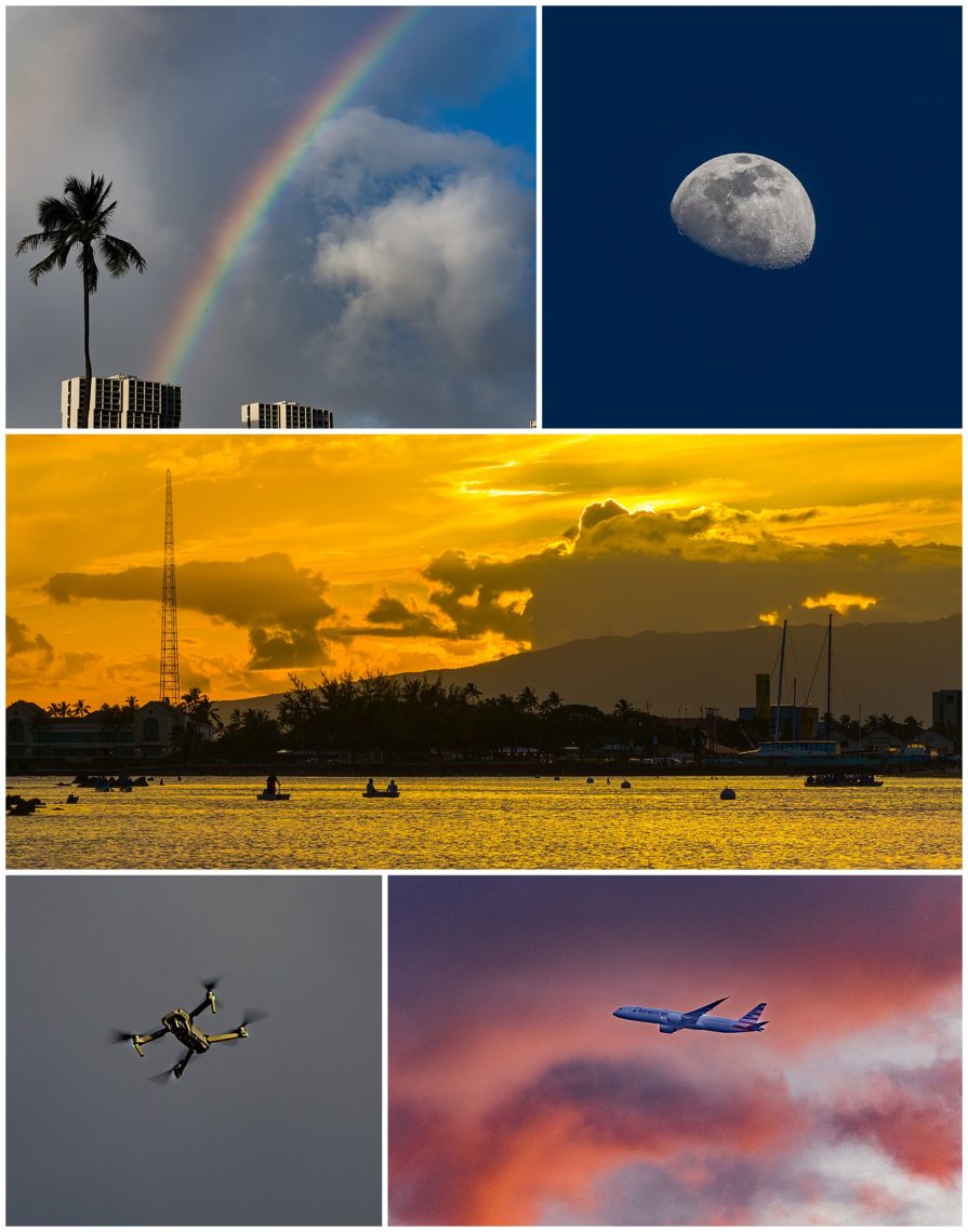
The sky got into the act and provided a show for all attendees too. It rained for about 5 minutes — just enough to show us a nice rainbow (upper left), and a 3/4 moon passed overhead (upper right). Flights from the Honolulu international airport pass just off the coast, and the sky provided a colorful backdrop (lower right). Though the festival organizers asked multiple times that there be no drones, there were 4 or 5 people who ignored the request and flew directly over the crowds (lower left).
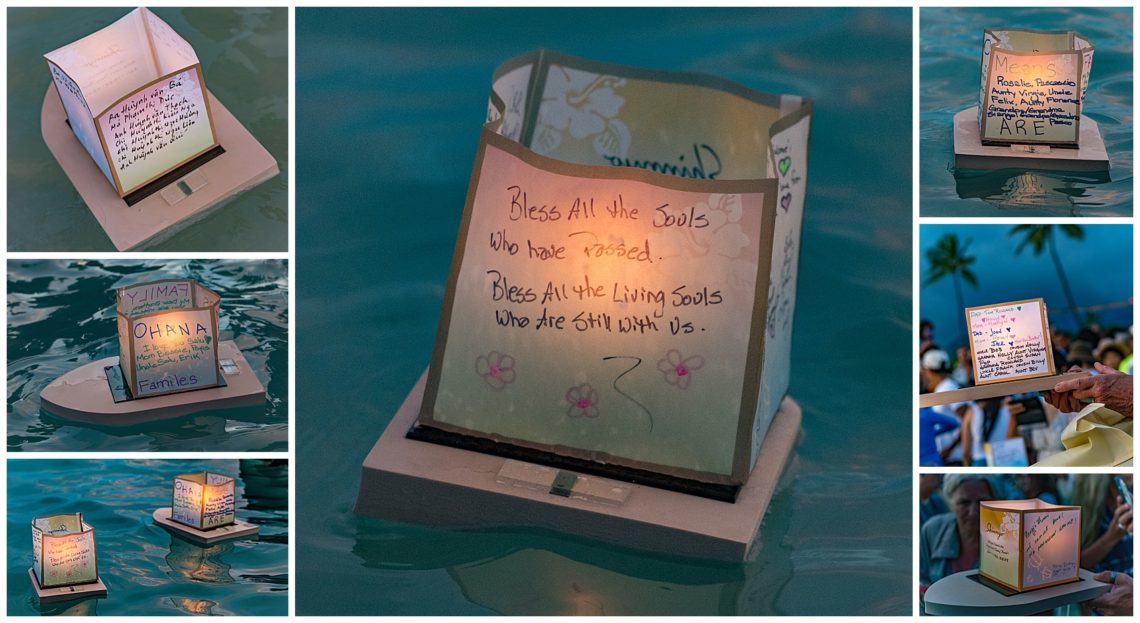
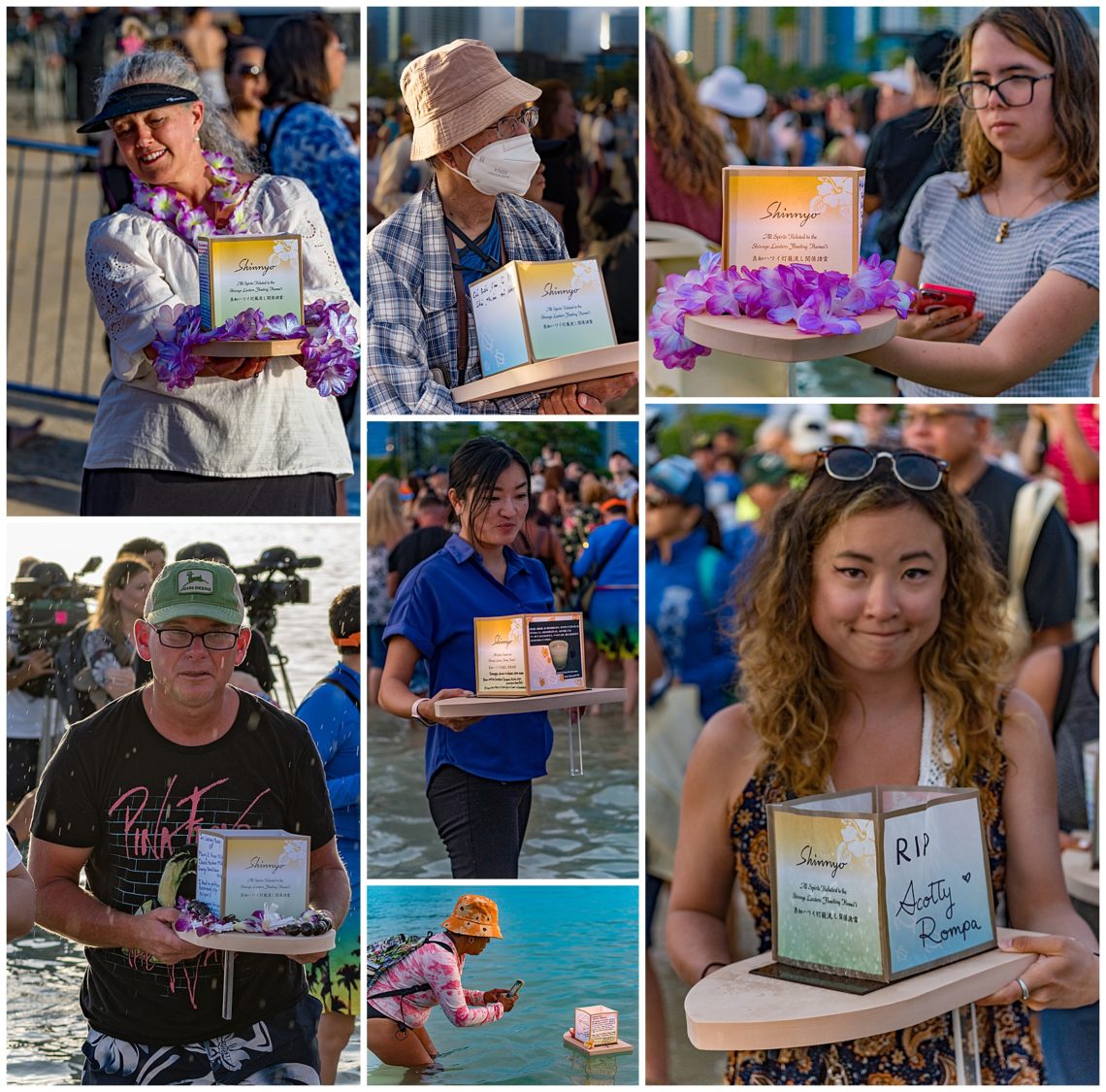
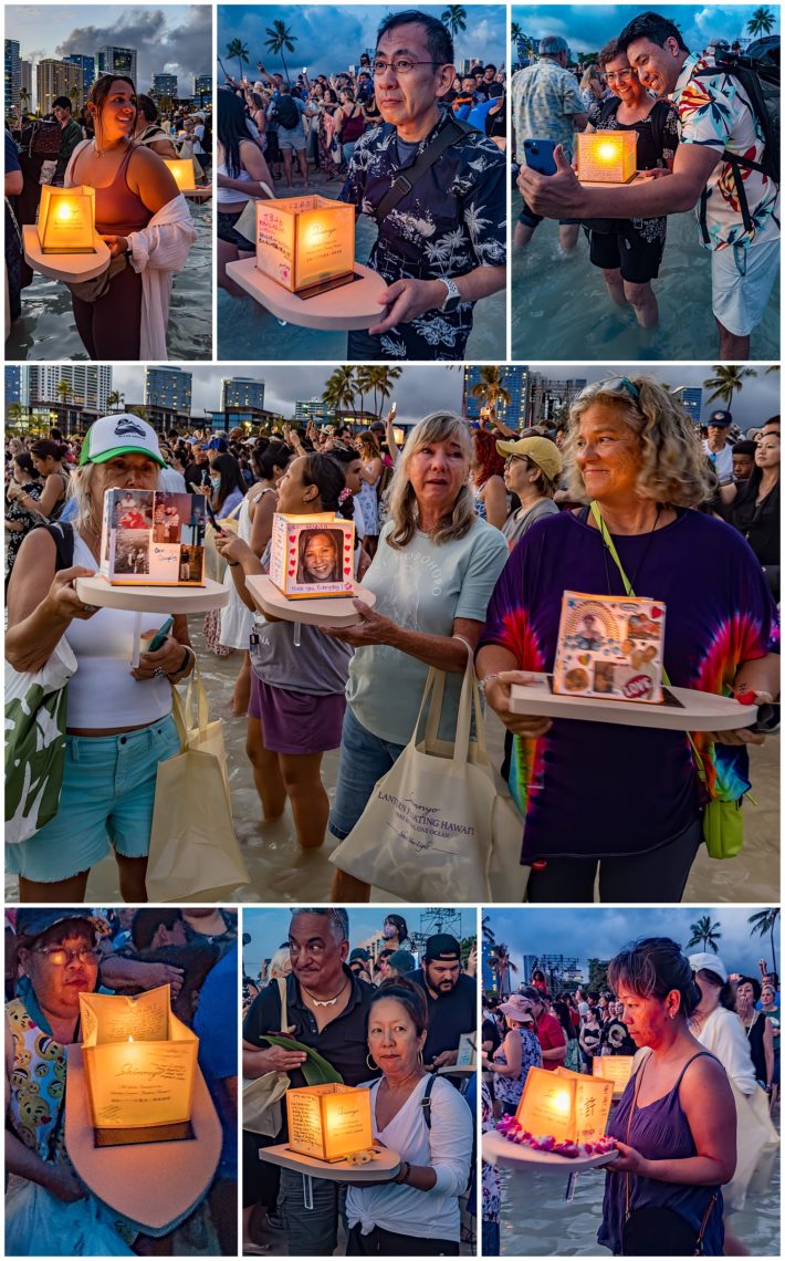
Attendees are only allowed to float officially provided lanterns, such as those above. The lanterns are made from a very lightweight wood that has been treated to be fireproof. Attendees can obtain one of the available 6000 lanterns per family for free. They then write their own remembrances onto the paper walls. After the celebration, all lanterns are retrieved to be reused the following year. “Remembrances and prayers are removed and handled in a proper and spiritually respectful way.”
With 6000 lanterns being launched, there was an almost unending parade of people to photograph. Above are a few of my favorites of people walking down to the water to launch their personal lanterns. It is a memorable event and extremely well organized.
Here is a short 80 second video to give a sense of the festival. It starts off with a portion of the Shinnyo Taiko musical performance, and then a couple of short segments of people walking their lanterns down to the water.
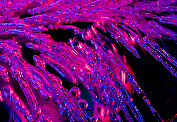
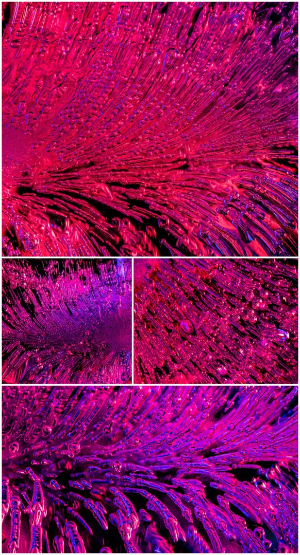
I have been experimenting with several photographic techniques in recent months. Now that we are between travels, I can spend some time in my studio. I thought I would share a few images from last night’s session.
These are all macro images of ice cubes. I used distilled water, then injected a small amount of soda water into the trays, and froze them in a styrofoam container in the freezer. That causes the water to freeze very slowly, making it crystal clear. The soda water injected via syringe during the freezing time inserts these firework-like threads through the ice.
I then put the ice cube on a glass sheet, and set the camera on a slider to give smooth motion. I fire off photos at 20 frames per second for about 5 or 6 seconds, giving me more than 100 frames of each ice cube. I throw away those completely out of focus at the start and the end, leaving me with approximately 60 frames where part of the ice cube is in focus. Those are then processed through software to do what is called “focus stacking,” taking the tiny sliver of ice in focus in each image and combining them to give a depth of field not possible in any physical camera.
In this case, I have a red LED on the right, and a blue LED light on the left, to give the colors in the ice.
I hope you enjoy them as much as I did in making them. These abstract images are my first real successes with this technique after 3 months of trial and error!
The Republic of Bolivia was founded in 1825. Although Spanish is the official language, there are also 36 Indigenous languages that are officially recognized. The indigenous people felt they were being ignored by the country’s political leaders, and it is estimated there are between 40-70% of the 12 million population are indigenous and minorities. In 2009, a new constitution was created, which greatly increased the rights of the indigenous peoples, and officially changed the name of the country to the Plurinational State of Bolivia.
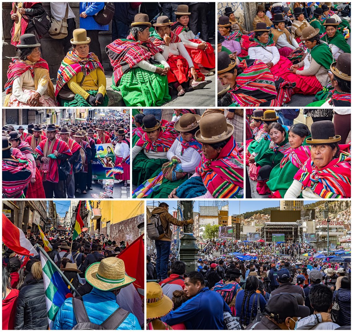
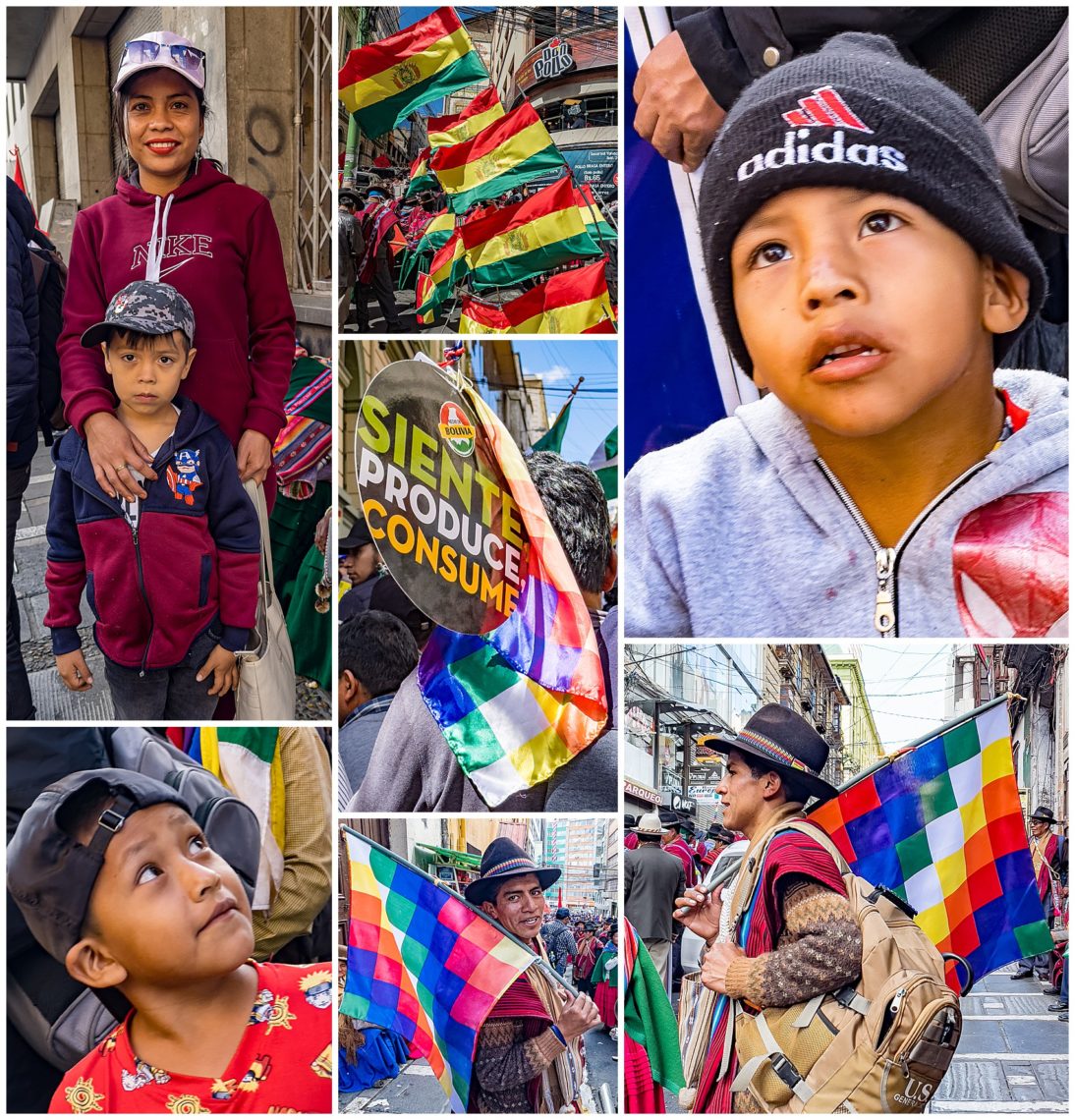
We returned to La Paz on our last day, to catch a flight to Lima, Peru which would return us to Cuenca, Ecuador the next morning. To our surprise, it was a national holiday and there was a major parade going on in the streets outside our hotel. When driving to the hotel, there were busloads of indigenous people coming from the rural areas to join in the celebrations, and the street to our hotel was blocked off. The lower row of images barely gives a glimpse of the size of this celebration. The parade is shown lower-left, but it actually goes off well past what we could see, as it had already been going for hours before we arrived on the scene right in front of our hotel. There was also a large outdoor stage at San Francisco Plaza (lower-right), with concert-loud music and political speeches, filled elbow-to-elbow with people. There were few non-Bolivian tourists and Mestizos (people of mixed ancestry) in sight. We were warned not to bring out our DSLR cameras, and to only use our iPhones to photograph.
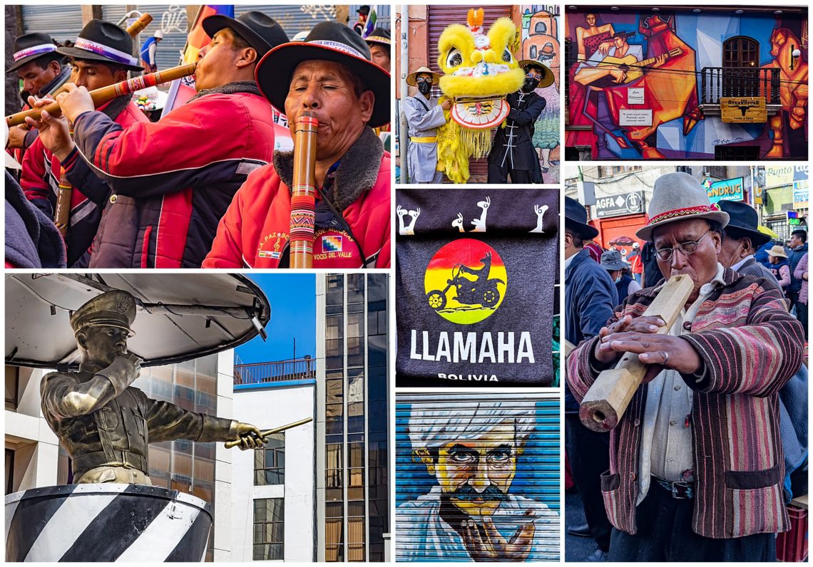
This parade was part of the national holiday and comprised of indigenous Bolivians, celebrating the 2009 changes that expanded their rights. As with any parade, there was accompanying music. The music was almost solely of wooden flutes handmade by the musicians (top-left and bottom-right), plus drums. This parade also coincided with Chinese New Year, and we saw one small group on a side street performing the lion dance with a Chinese Lion (top-center).
As we wandered looking for dinner, we came across a uniquely Bolivian Yamaha motorcycle shirt (center). Before the advent of street lights, policemen would stand in elevated platforms blowing their whistle and pointing, to direct traffic. This very realistic statue (lower-left) was just outside our hotel door, in honor of that lost profession — I had to do a double-take before I realized it was a statue, rather than a policemen telling our driver what to do!
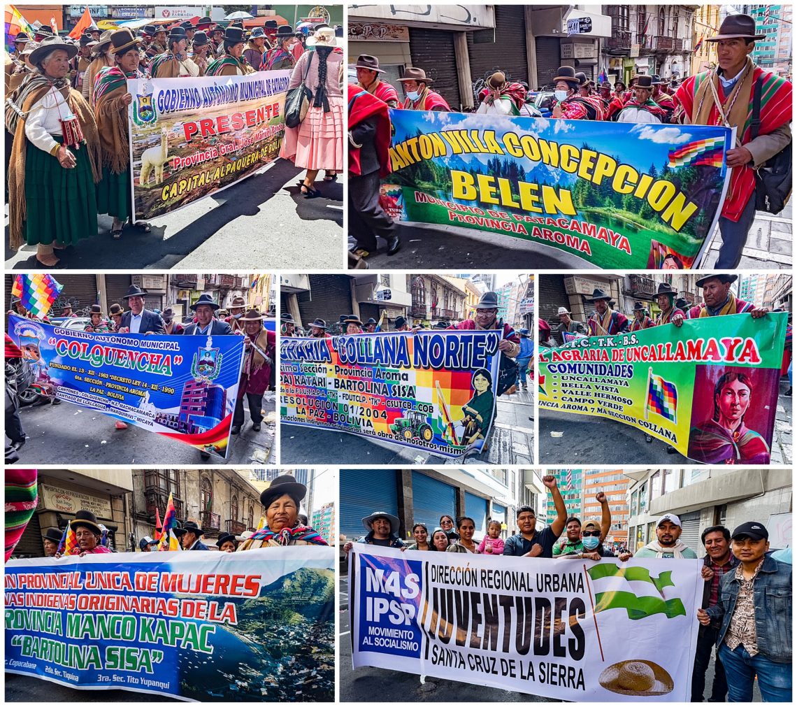
The parade appeared to be broken into many dozens of small indigenous groups, each with a banner promoting their particular interest. Unfortunately, we had no idea what most of these banners were about. A straight translation did not really shed much light in most cases. I expect they would make more sense if we knew the local politics and issues better.
Besides the group banners, many men also carried flags. A surprise to us was that indigenous men welcomed getting their photos taken. And, of course, there were also kids, a subject we often love to photograph.
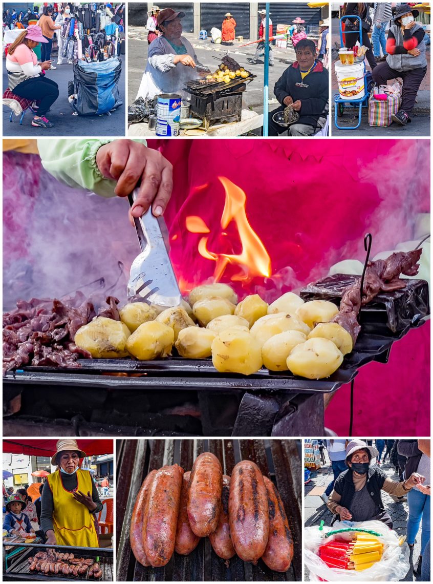
Another staple of any parade is a supply of food vendors selling street food.
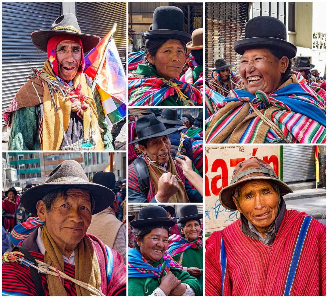
It was often hard to tell who was part of the parade, and who was a spectator. In many cases, people would come out of the parade, sit and rest awhile, then return to the parade. There were also a couple of media people there, using camera phones and small pocket microphones for interviews. The man in the center is shaking his fist to emphasize a point he is making to the journalist holding the microphone for him to speak into. We were awed by by the variety and color of the traditional clothing, and the friendliness of the Bolivian people.
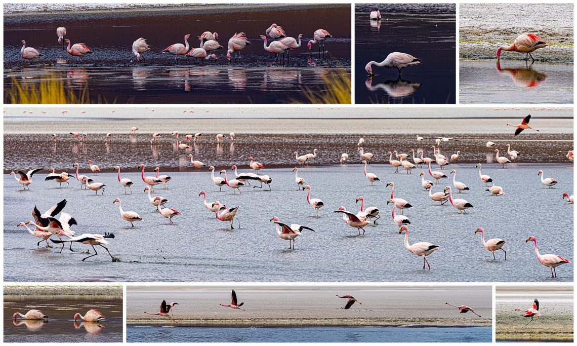
We have finally reached the end of our journey in Bolivia. We did not see everything we had hoped to, but did manage to capture some scenes that were unexpected. In some ways, the flamingos were a highlight of the trip, so we will end with one last collection of images of those pink birds. Our guide showed us video he captured just a month earlier, with the flamingo mating dance, which was something National Geographic might have filmed.
The scenes of Bolivia were quite varied on our trip. Rather than showing a series of short videos on this topic or that, I decided to create one two-minute video with scenes from throughout the week. I hope you enjoy the video — and rest of this photographic presentation — as much as we did in putting it together.
Photo Galleries
At the top of this page is a menu that will take you to a variety of galleries showing our favorite images.